Quite an amazing tunnel
As I loaded the bike I had a fun chat with my host Sjanni, another enthusiastic cycle tourist.

Sjanni is a great fellow and I wish I’d had more time to spend with him!
I was looking forward to today’s ride because it included a tunnel – the Fáskrúðsfjarðargöng – 20,000 feet of road straight through a mountain and open to cyclists.

Spot the cyclist!
I stopped in town for some breakfast and email with nephews. One of them was feeling despair over the state of the world.
It’s difficult to pay attention to work when the world is slowly ending. I can’t stop seeking information about the collapse. I wonder if I’m crippling myself by going to college to get a degree that might not be worth all that much and it might not matter if the country has burned down yet or been flooded or both. Also corporations are buying all the houses here so I’m fairly certain I’ll be renting my whole life. I’m sure my 20-something endocrine system isn’t helping here either.
I thought for a while, then emailed back:
Civilization and the planet will survive while you to spend some time concentrating on your own development and diversification. It’s a process and you don’t need to tackle it all at once or figure out where it should go. Take it one step at a time, one day at a time.
What I didn’t say at the time, was that I could remember being his age many years ago, and overhearing my sister – his mother – expressing the same frustration and despair. And I remember our Dad replying with pretty much the same advice.
That gave me two interesting thoughts: First, that young people are always prone to think the world is ending, because they haven’t been around long enough to see otherwise. So conversations like this will happen forever, no matter how good or bad things get.
And second… How much worse was this, centuries ago, when the world seemed to be at the mercy of inscrutable gods, and people usually didn’t quite live long enough to learn that the world would carry on past their own hormone-addled youth?
That’s the morbid angle on this “wisdom”: It truly sets in when you witness people your age – or even younger than you – dying, and then observe years, then decades, of the world continuing without them. And perhaps not into a future they would have expected, but in some way that’s real enough, and teeming with other living people who still have to deal with it.
This global pandemic business. Great for the soul, yeah? Ugh. Interesting times — who needs them!!

Aww, two little arcade machines! That’s adorable!
Anyway, the store had salty potato snacks and chocolate milk, so my picnic basket was full. I set out for the tunnel in perfect weather.
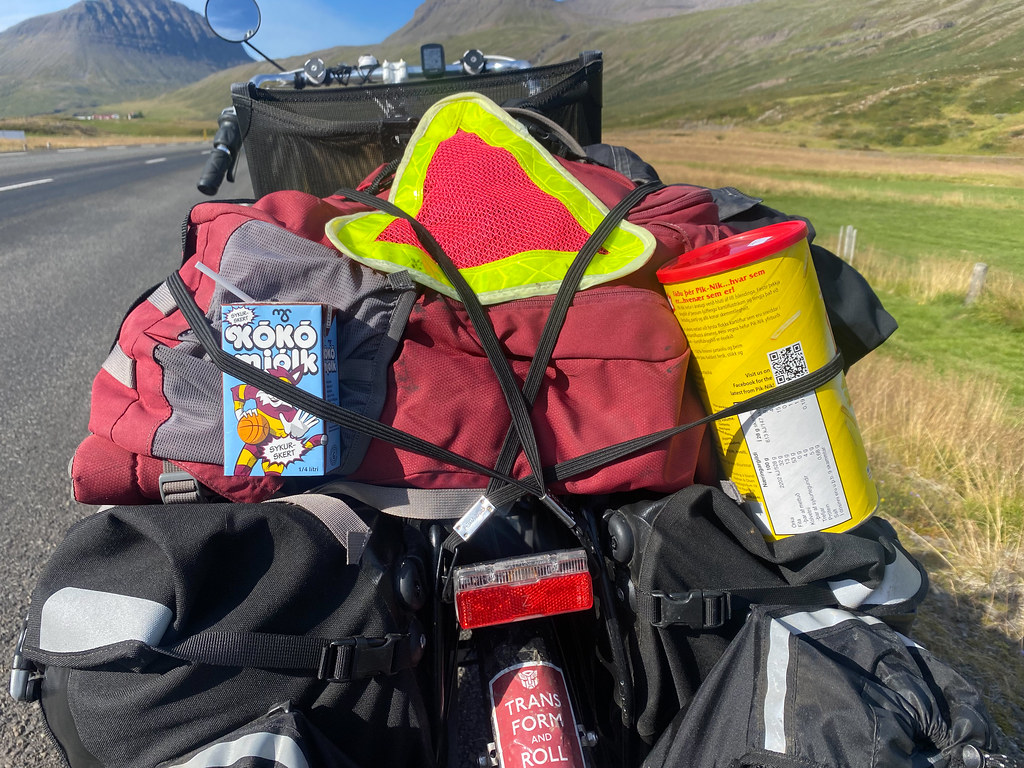
Have snacks, will pedal!

Huh? Whaaaa?

I think it would be cool to have hills like this all around my farm. Might get annoying chasing after lost sheep though.

It almost looks like the mountain is venting steam.

Clouds doing weird things over the peaks.

Just a liiiiitle snow left up there.
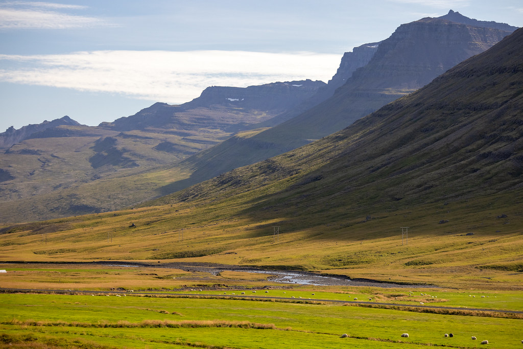
Lovely view. Unfortunately it looks warmer than is actually is!

I hereby name this region ‘Sheepy Hollow’!

Every time I make a baa-aa-aa noise at them, the sheep get slightly more confused.
In due time I arrived at a big kiosk by the side of the road, with a map. Getting close!

Guess what this marker means!
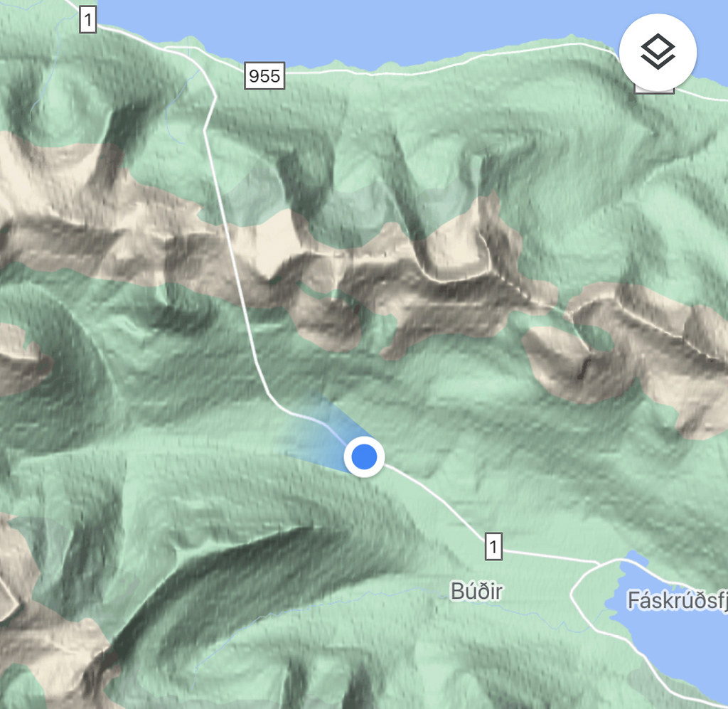
Today’s route appears to go straight up over a mountain! No wait, that’s a tunnel.
And there it was… The portal down into darkness. I didn’t realize until I got this close that the tunnel slopes downwards from here, for the entire run. A good idea for drainage purposes, and also for dramatic effect. It feels a whole lot like descending deep into the earth.

Oh boy, this one’s a long one!

Tunnel time approaches.
The first thing I did was stop and take a photo looking back. Goodbye, daylight!

Looking back. See ya later, daylight!
I realized the traffic was very calm, so I got ambitious and took a long-exposure shot with the camera resting on the center line. So shpooky!

10 whole minutes of coasting silently downhill into the mountain. Very trippy.
And then, off I went. The slope seemed to grab the bike, and the cool air being drawn through the tunnel by the turbines on the ceiling streamed over me, making it feel like I was going faster. I had a brainwave and put on some music from the Skyrim soundtrack: The chanting and drumming of Sovngarde. I had plenty of time to play through the entire track, because 20,000 feet of tunnel is nearly 3.8 miles (6km). At a breezy 15 miles an hour on a bike that’s fully 15 minutes of creeping downward through solid rock, imagining that I’m on my way to some eldritch ruined city abiding in total darkness, teeming with ghosts and adventure.
I love being a nerd!

If you look close you can see the tunnel I came out of.
Once I was out of the tunnel, I paused for a look back. The exit was clearly lower on the mountain than the entrance, making the mass above it even more impressive.

Better watch it, motorists!

Some impressive sides to this valley.
The town of Reyðarfjörður was on my right, sporting some nice waterfalls and snacking spots, but I was too interested in forging ahead over the hills to Egilsstaðir, where the next room was booked. The wind could turn against me any time, and I didn’t fancy another late night on the road.

I was tempted to walk over and put my feet in, but I figured the water would be far too cold, and my socks would take far too long to dry.
Along the way I passed a relatively rare sight in Iceland: A memorial to a roadside fatality.

These roadside memorials to dead motorists are rare in Iceland, but no less saddening for it.

If I’m reading the sign correctly, the motorist was only 16 when she died here.
The rest of the journey was a slow pedal against mild headwind, through a narrow and relatively featureless valley. I say featureless, but it was still very pretty. I listened to a podcast about world economics and kept on cranking.

So many waterfalls!

Pausing at the rest area for a photo and a wee!

Lots of spinning on those cranks to get up here…

Zig-zaggy waterfalls!

Only a few cars on this stretch today, which is a nice change.

The highest point of today’s ride.

The curves are especially dramatic because there isn’t a single tree to interrupt them.

There’s sheep in them thar hills!

Weird perforated sunset clouds.
I arrived at an intersection, and suddenly realized that for the first time in many weeks, I’d crossed my own path from 2019. Once again I was in Egilsstaðir.
Time to find more snacks!

Here’s a place that looks like it can serve up a lot of calories.

This guy’s name is Patti Burgersson. (I’m lying.)

Got a lot of snacks in the fridge today.
Snack-laden, I found my hotel and wrestled all my gear up several floors to the room, including the bike. It was good to be indoors and warm again, and the food gave me enough energy to put in some work hours before falling over.