
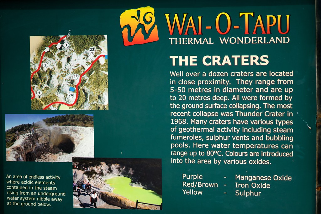
NZ Day 15: Hot And Steamy
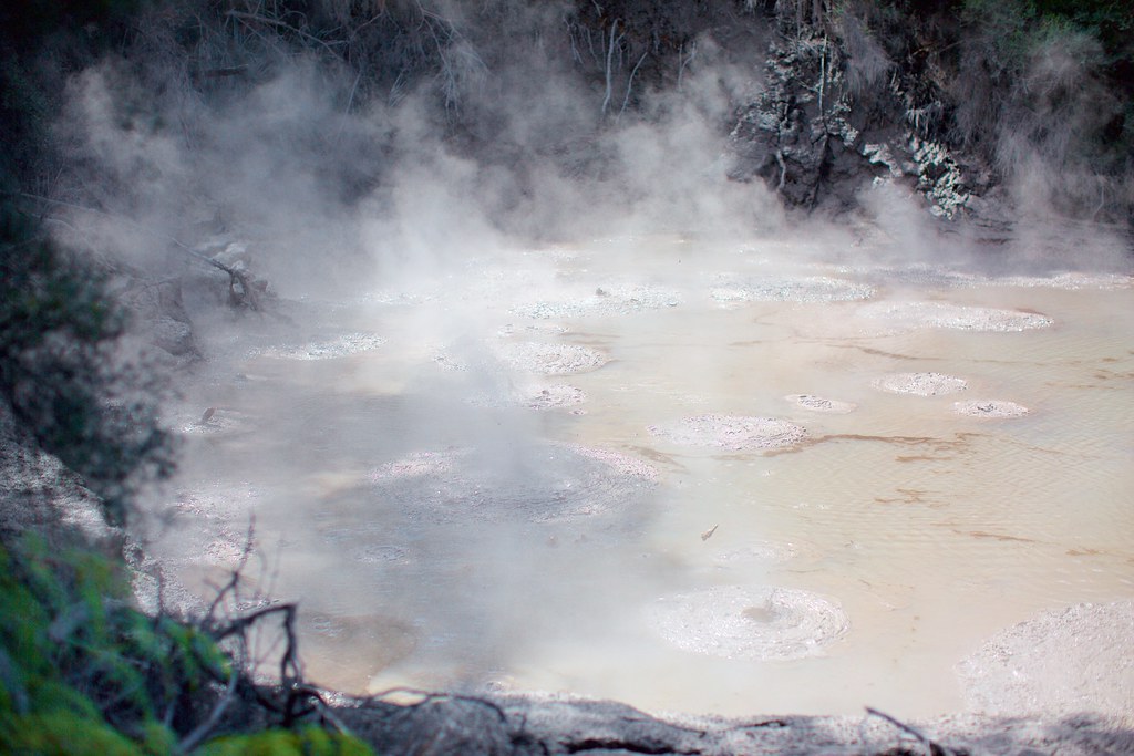
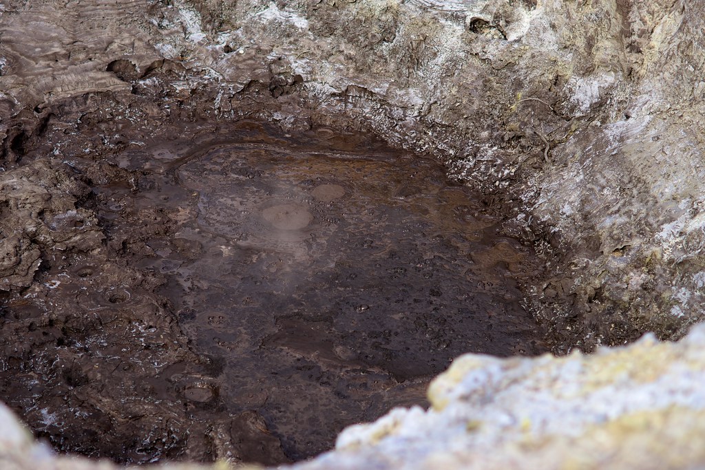
So, we set off a-wandering from the Waiotapu Tavern and in a few hours we were face-to-face with this:

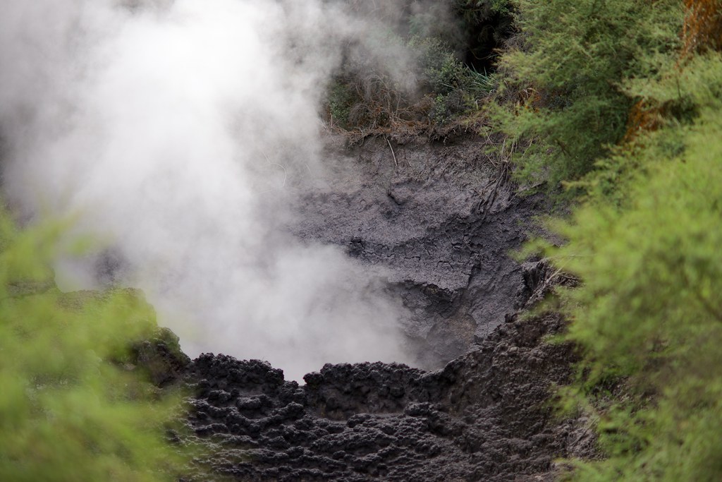
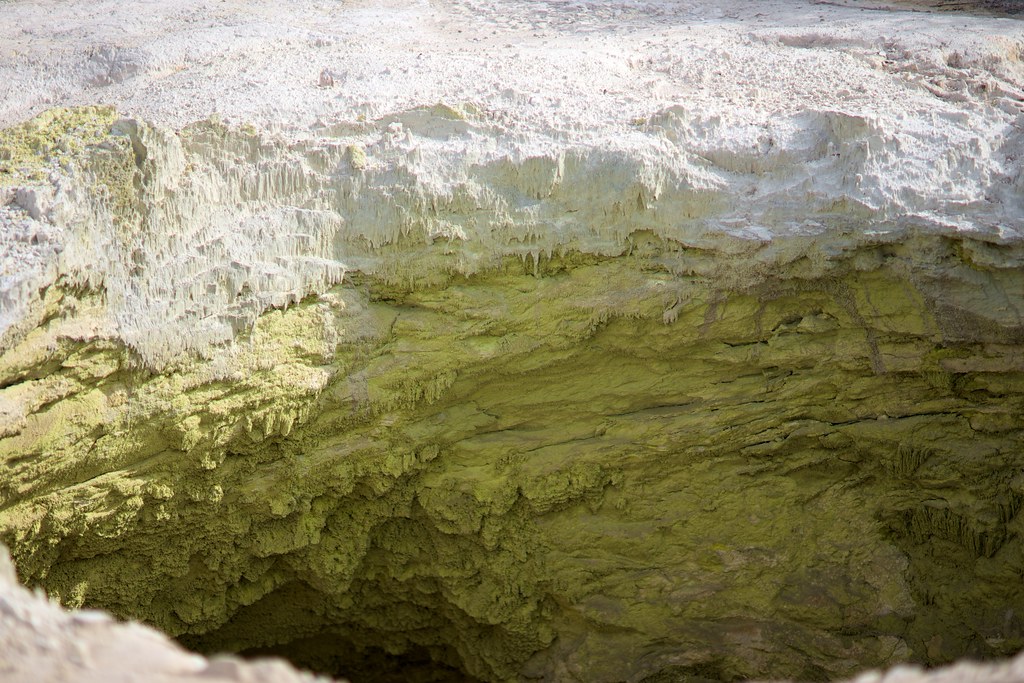
A great, big, boiling, festering mud hole in the middle of the forest!
You probably can’t hear it in the video, but it’s making noise like a couple of horses throwing a dance party in a closet. An endless, semi-rhythmic thudding sound that doesn’t just vibrate your ears, but vibrates the whole area around you.
The truly great thing about this experience was the act of discovery. Kerry and I just crept into the untracked forest to find the source of a mysterious noise, and ended up staring at this infernal thing. No guideropes, no fences, no warning signs. Not even anyone else around. If your judgement is poor and you tumble over the edge, you will die, and chances are nobody will even discover your corpse for a long time. By the time they do, your flesh will be boiled into mush, leaving only a stew of bones and some expensive equipment to tempt the next victim.
Awesome!!
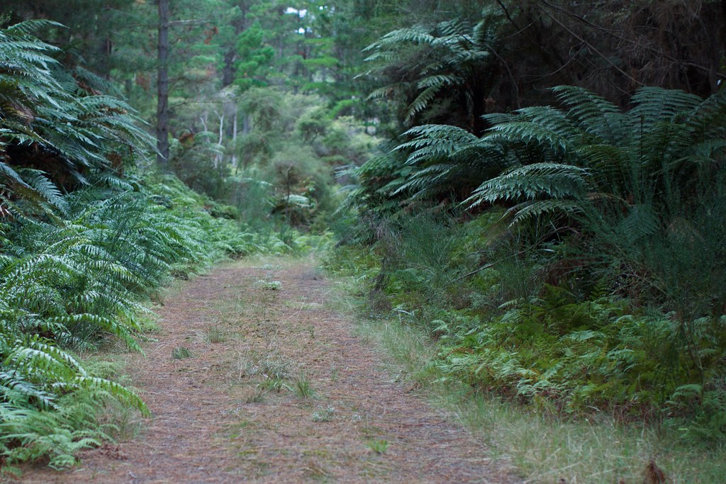
But I’m telling this tale out of order. We didn’t go wandering straight into the forest, we ended up there after exploring a slightly overgrown path leading away from the established touring area. We didn’t see any signs warning us away, so like most optimistic and slightly devious tourists, we “assumed it was allowed” and kept going. I know; we’re monsters.
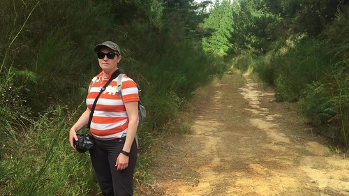
Here’s the route we walked:

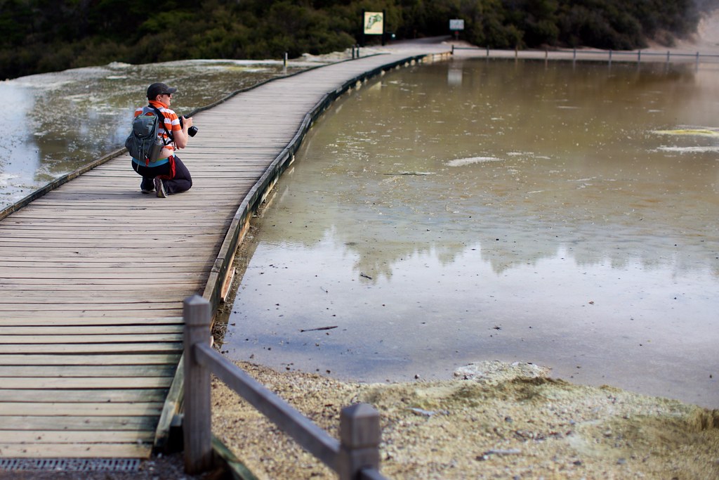
Only part of that is off the beaten path – the part labeled “Thermal Road”. After an hour or so of quietly exploring it we did become rather nervous that we were breaking some rule, simply because we never saw anyone else around. By contrast, the first area we saw – a series of mudpots with nice walkways around them – was crowded with tourists, even during this off-season day.
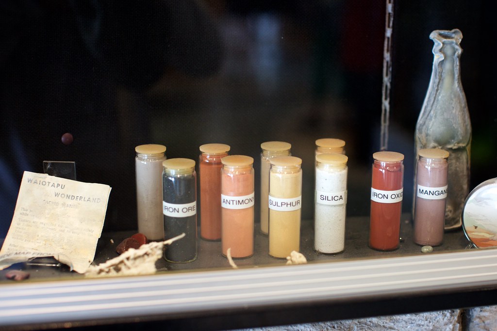
The smell of sulphur was intense!
That area was well-worth photographing, too. I could see why the government had decided to build fences and guardrails there. Small children were running around, and I’m sure that when some of them first saw the bubbling pools, they were seized by desire to jump into the mud and stomp around as though it were just another squishy creek-bed. That would not end well, of course.

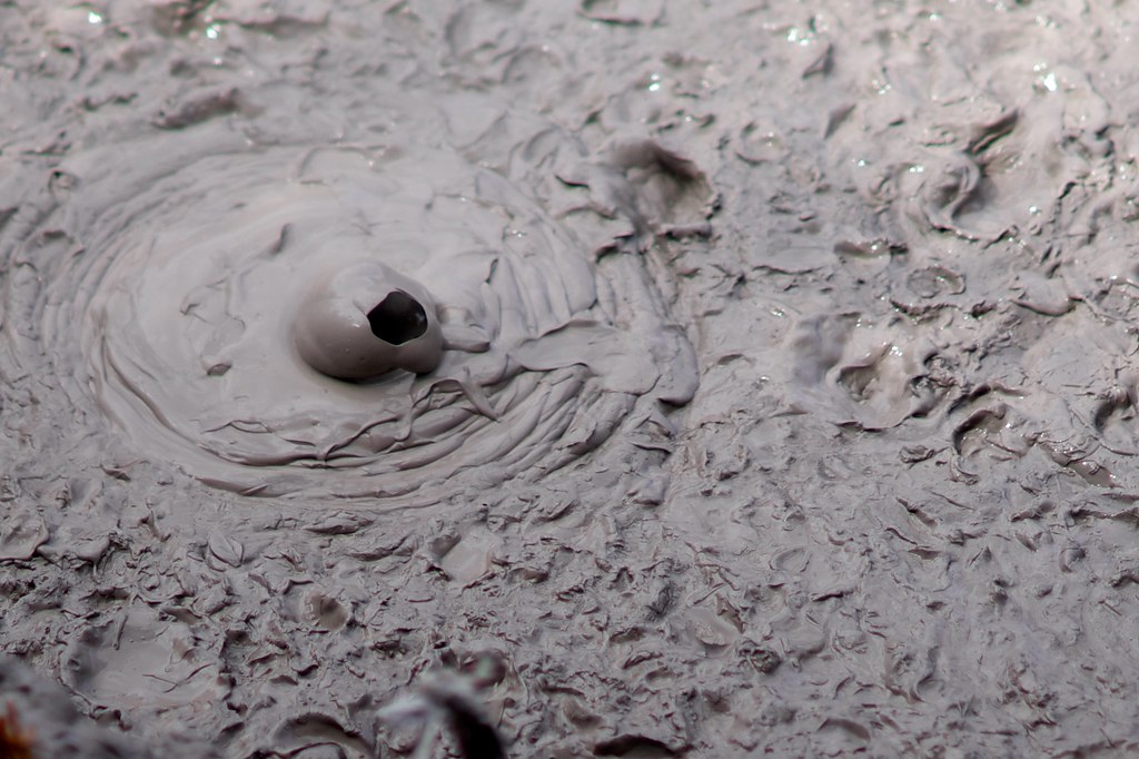
To tell you the truth, I was tempted too. At times the mud looked like melted chocolate, and I felt the totally irrational urge to scoop some up with my bare hand and lick it, just in case it turned out to be delicious pudding.

WE HAVE LIFTOFF !!!
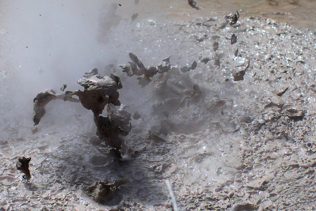
GABLOOOOSH !
The fact that this “pudding” was constantly exploding upwards towards my face and squeezing out plumes of steam should have totally cancelled that urge. But it didn’t. Every few minutes or so I was thinking: Mmmmmm, delicious chocolate…
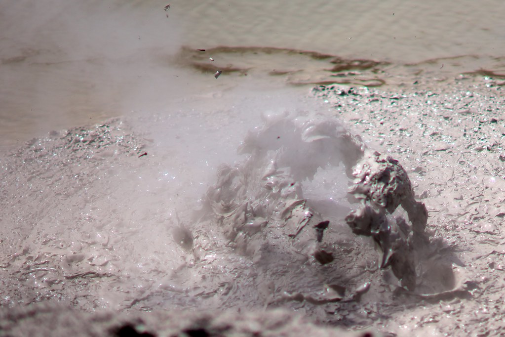
Glllooooooorrrp!
KAPOW !!!
Delicious fiery exploding chocolate, melts your mouth – and your hand – and practically everything else in your body. Even at regular temperature, the water in the mud is still dangerous because it’s acidic, and would be unhealthy to swallow or even bathe in. This is pretty darned far from a nice chockie treat. AND YET…

Mmmmm, steaming hot pools of deliciousness! Maybe it tastes like ramen? That reek of sulfur could just be boiled eggs… Argh, stupid human brain! Stop that!
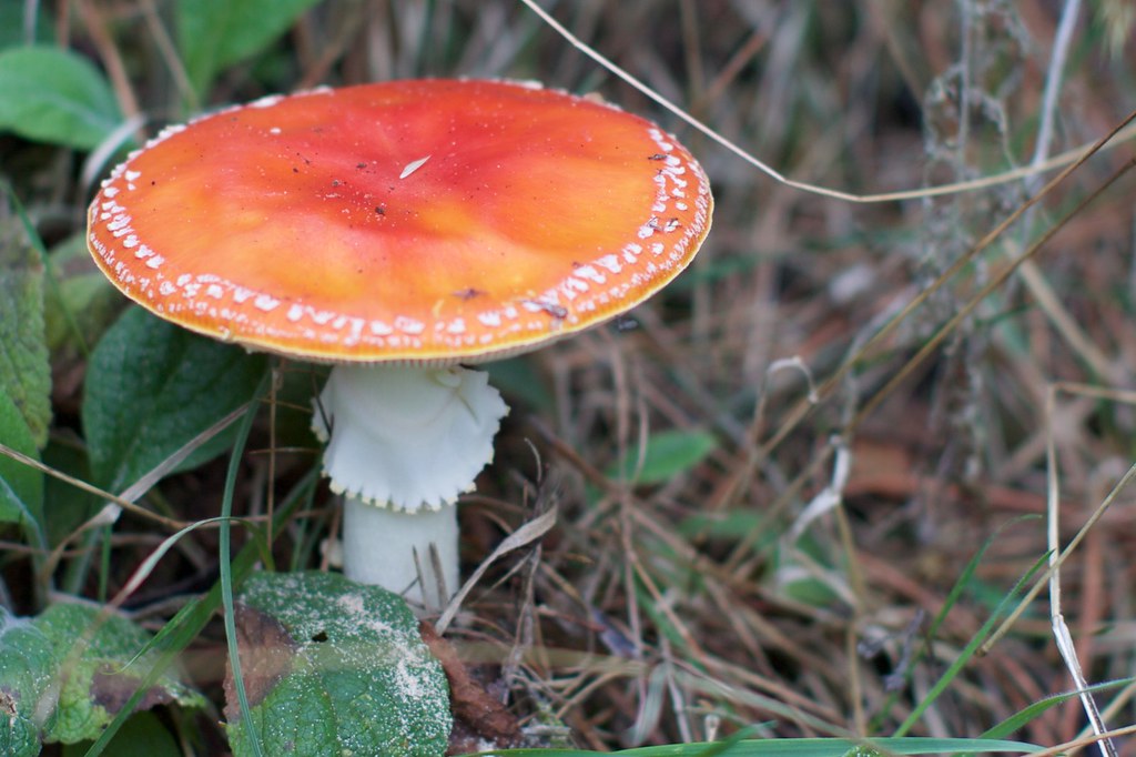
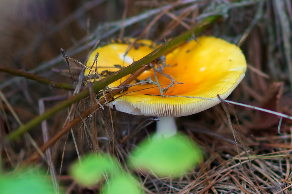
Also not to be trusted: Colorful mushrooms just a few steps off the trail. Don’t believe their candy-coated lies!
This is Thermal Road in all its glory:
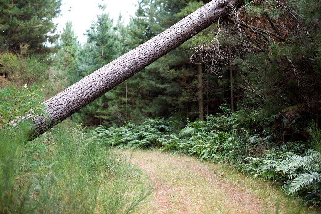
We knew it wasn’t good for vehicle traffic because we found several trees laid across it:
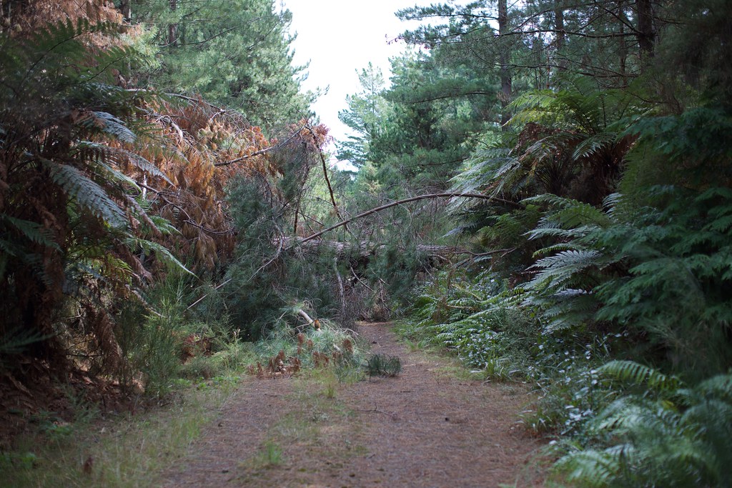
This is one of the many trees that fell across the road. They didn't stop us!!
Road's gettin' harder to see!
No trouble for explorers on foot, of course.
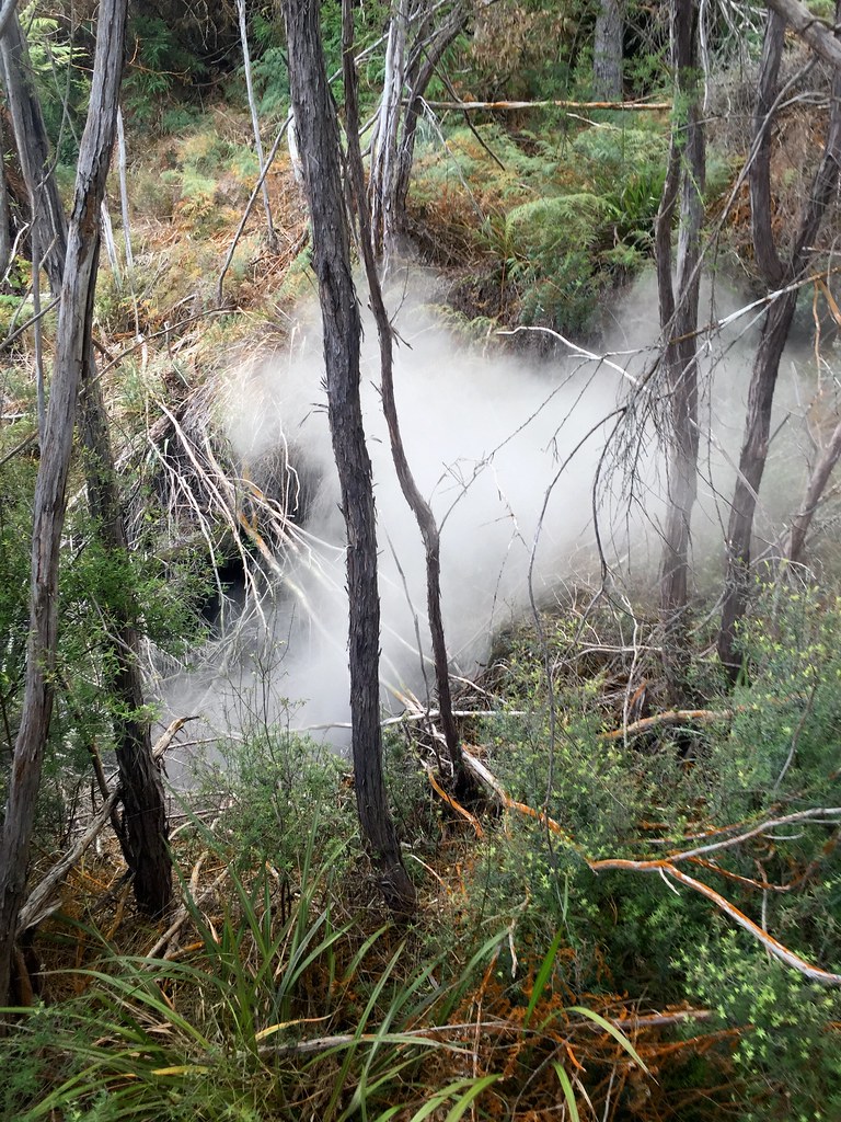
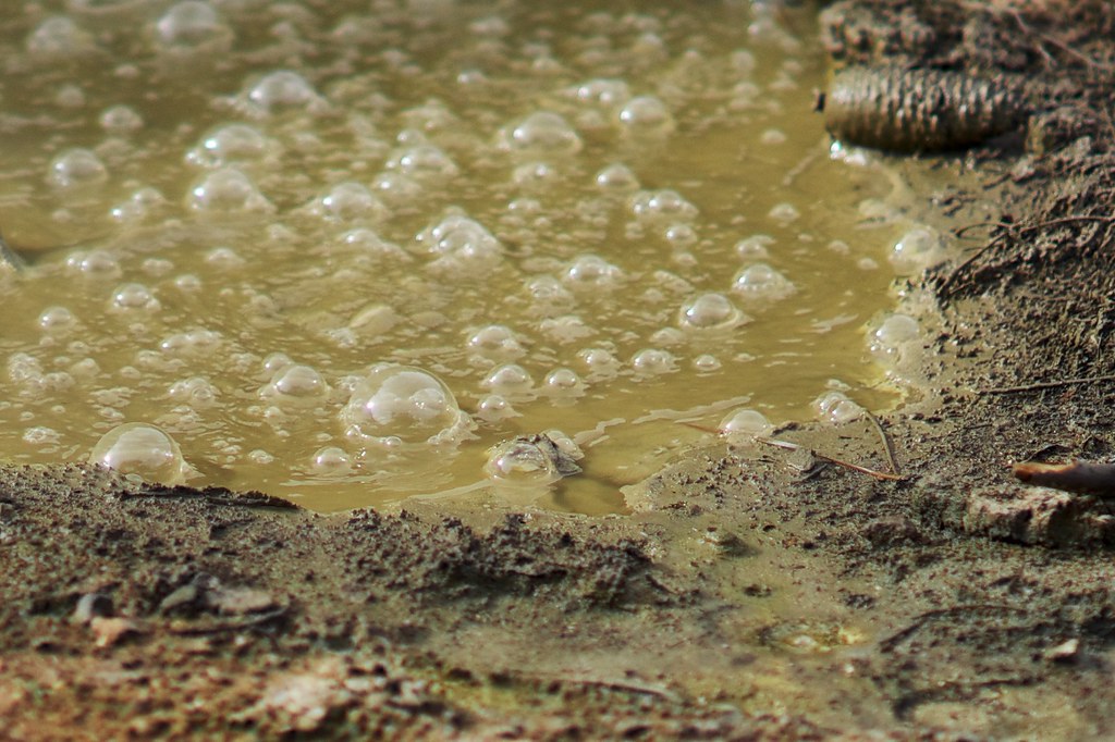
Along either side of the road we could see bubbling pools, some filled with mud, others clear and shrouded in vapor. Look! I made soup!
Look! I made soup!
This was definitely not part of the standard tour-on-rails. One inattentive step over the embankment and you could be in serious trouble. Check out this video for an example:
Some of the weird sights – and curious sounds – were just too far behind thick foliage for us to go bushwhacking over to them. Plus there was that nagging feeling that we were disturbing an environment better left alone. If it wasn’t too far from the road and we could get to it only with footsteps we felt it was worth a shot.

During one tentative off-road exploration I encountered this scene. My main camera’s 50mm lens couldn’t capture the whole thing so I took a panorama with my phone.
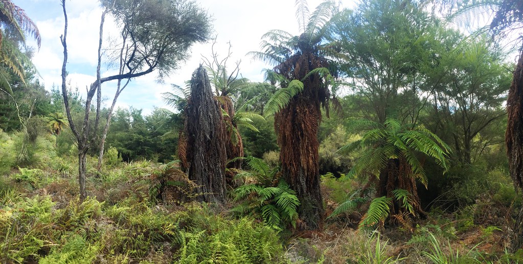
Dementors of the forest. Creeepy!
You’ll have to trust me when I say it was one of the creepiest moments in the whole trip. Each of those central “figures” in the photograph was about nine feet tall and seemed to be reaching out to me as I stared at them. Kerry was waiting back on the road, out of sight, so it was just me alone in the clearing with these ghastly formations, mixed with distant bubbling sounds and the smell of geothermal activity.
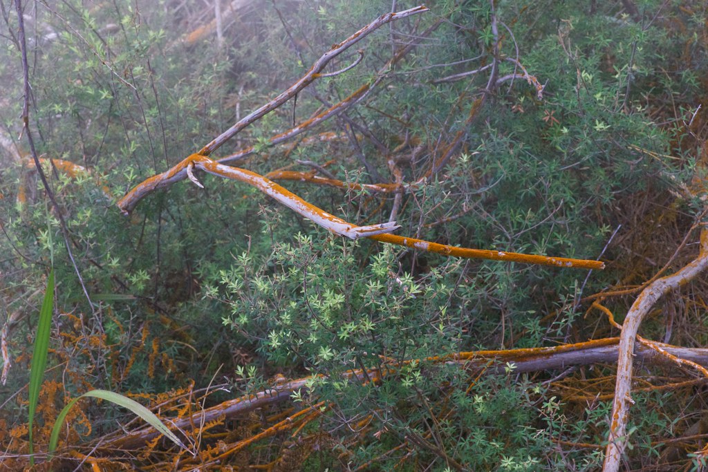
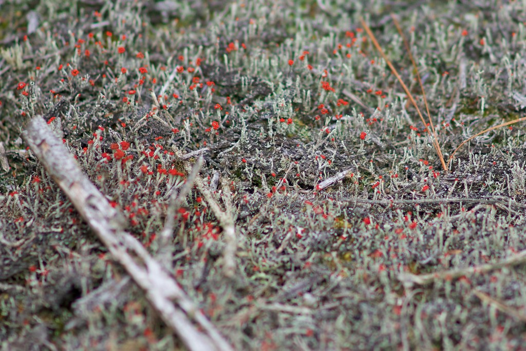
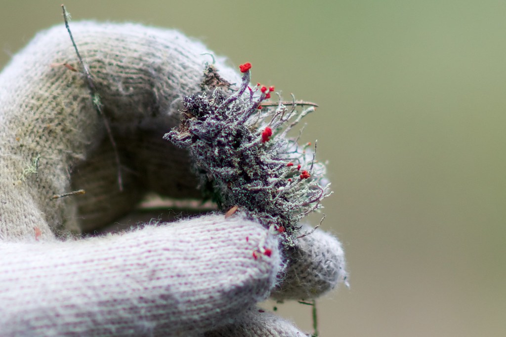
In other places, the smell intensified into a flowing mist, whose mineral content fostered strange growths of lichen.
In some places it was growing directly on the ground like a carpet.
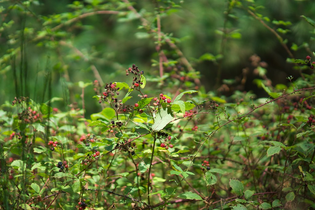
A little ways beyond the red lichen I encountered a horde of red damselflies. I don’t think there was any reason for the color-coordination, but you never know…
These little red damselflies were all over the place here...
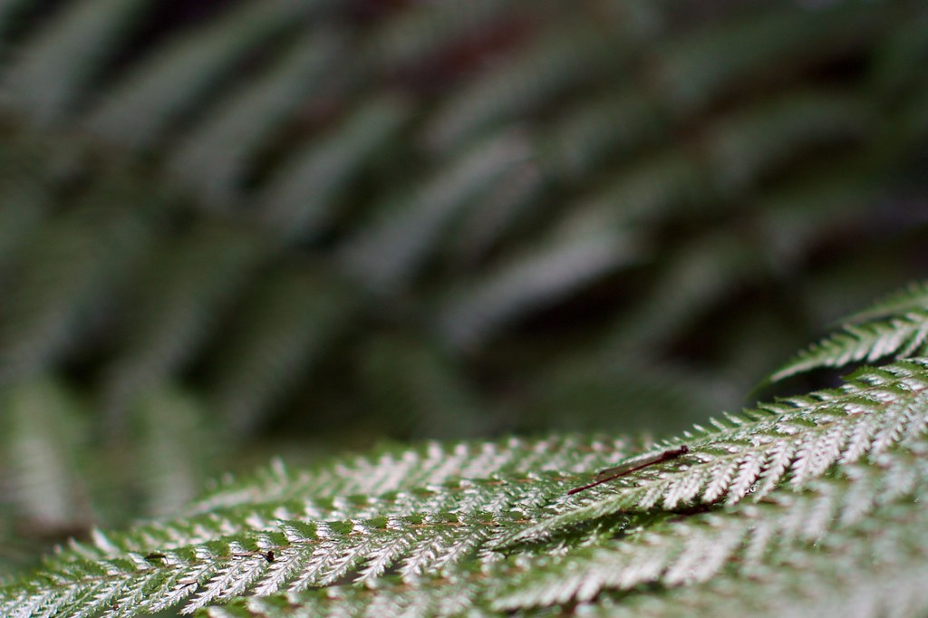
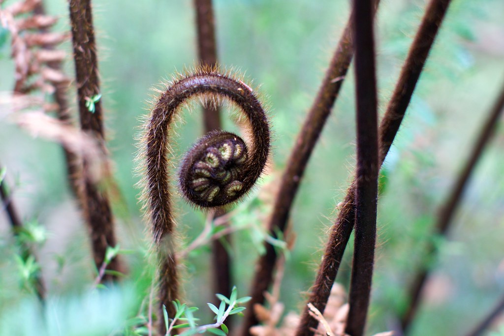
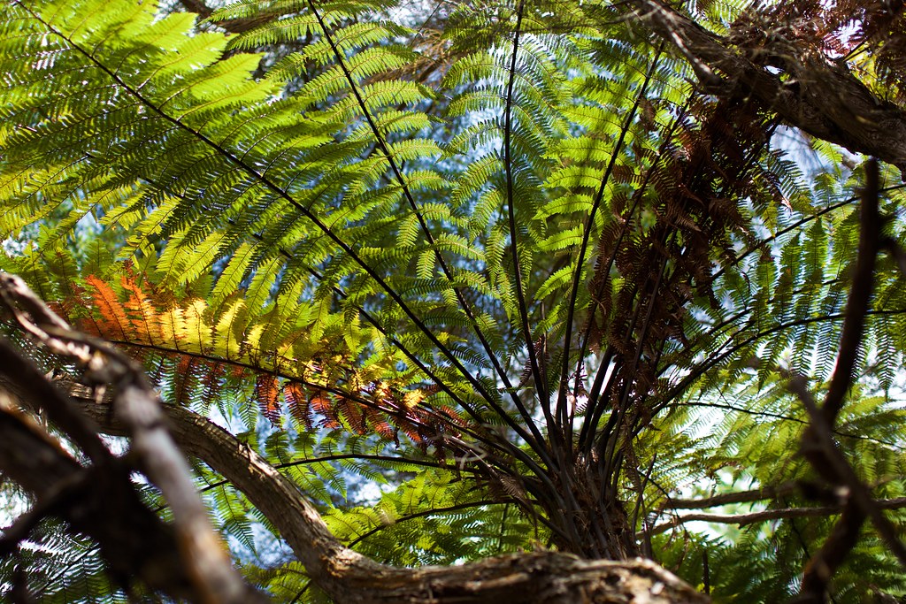
The intense colors and the layering of the vegetation was almost overwhelming. In a good way!
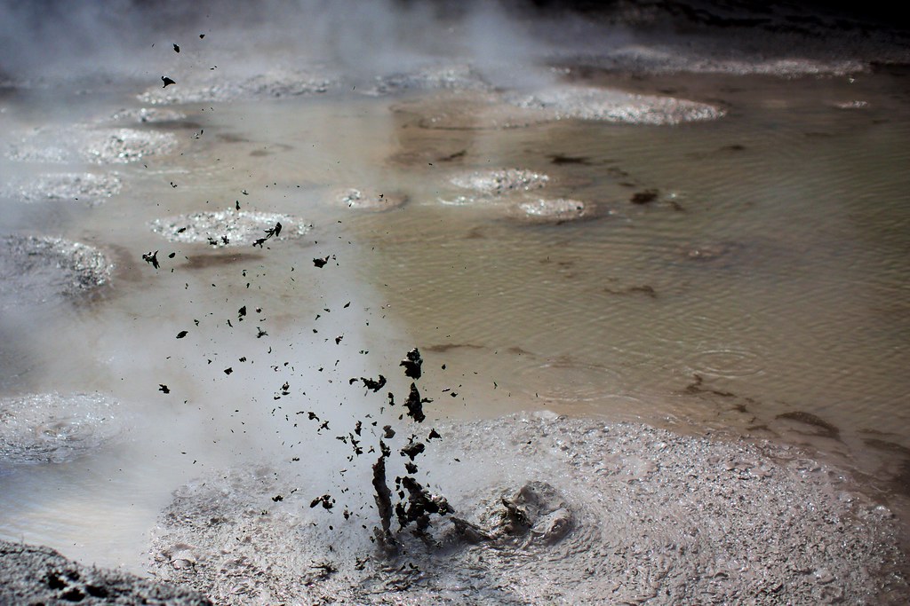
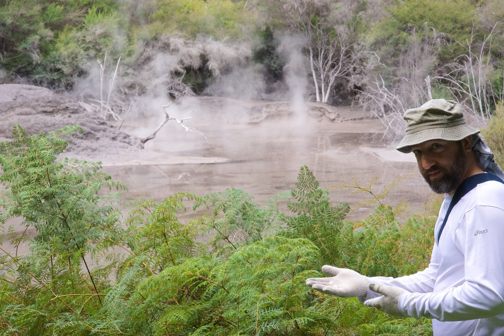
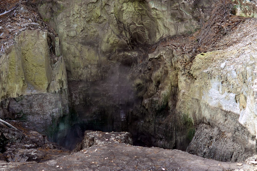
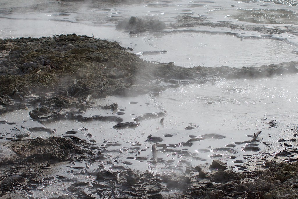
And then, we heard a particularly loud thumping noise – people on horseback perhaps – and went looking for the source, and got a big surprise:
Someone obviously left the kettle boiling way waaaaayyy too long.
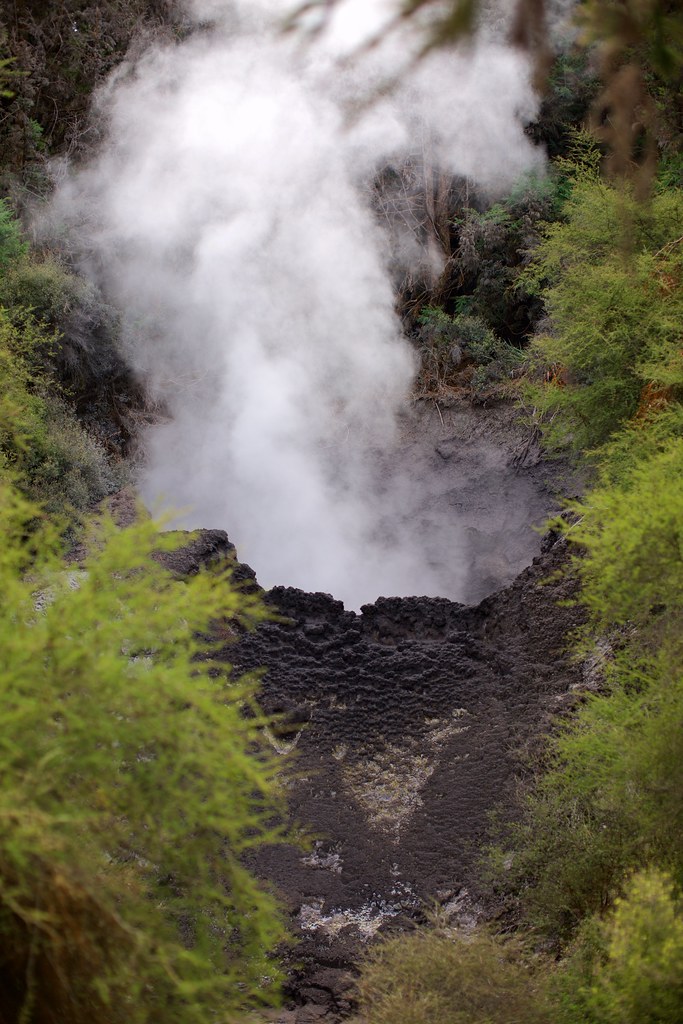
A great, big, boiling, festering mud hole in the middle of the forest. The sound and the smell was intense. We didn't dare get any closer than this.
At this point we were certain this was not part of the approved tourist package. No park service would ever endorse a hike around this unstable, delicate terrain. We took a bunch of photos and returned to the road, moving faster now. Ahead of us our iPhone maps showed an intersection with a road that split off to the right, eventually meeting up with the official-sounding Waiotapu Loop Road. In due time we saw some evidence of recent human activity, which was a relief even though we didn’t know how to interpret it:
Then we spotted a man-made clearing through the woods to our right, and cut through the trees directly towards it. We didn’t have a lot of faith in our digital maps, and we weren’t willing to follow the road any longer than necessary at this point.
On the way through the woods we did see some nice moss-on-moss action:
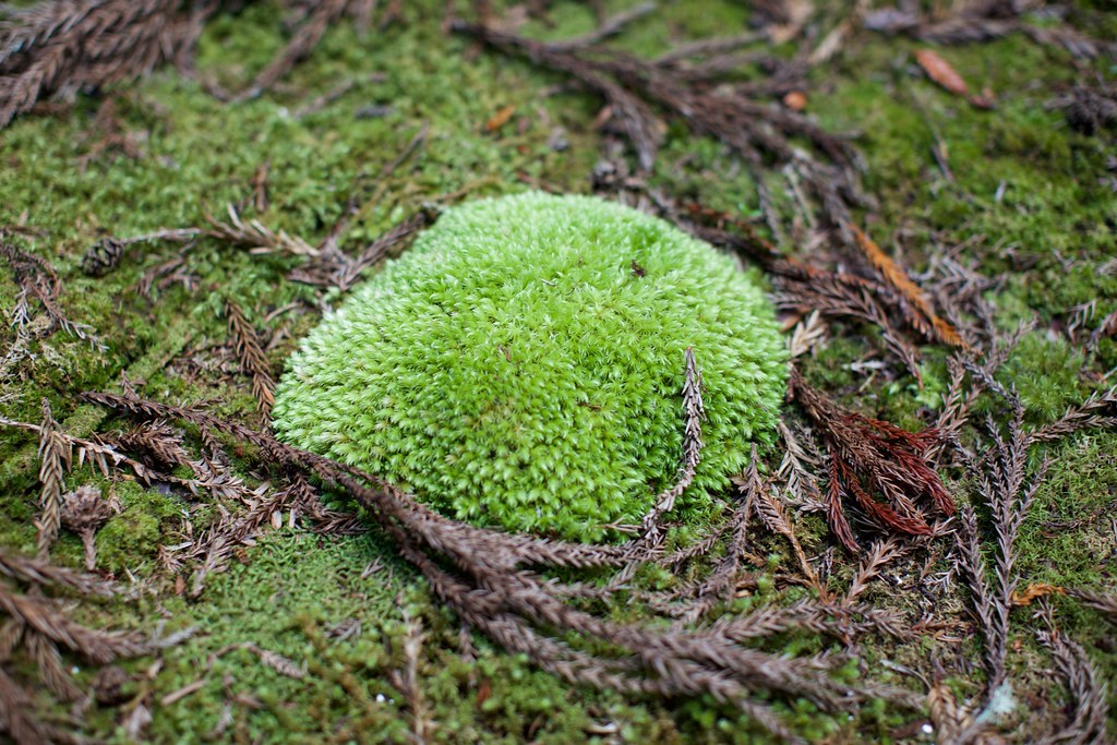
Fresh moss growing in a big bulge on top of old moss.
And Kerry took a photo of me investigating the moss, which I rather like!
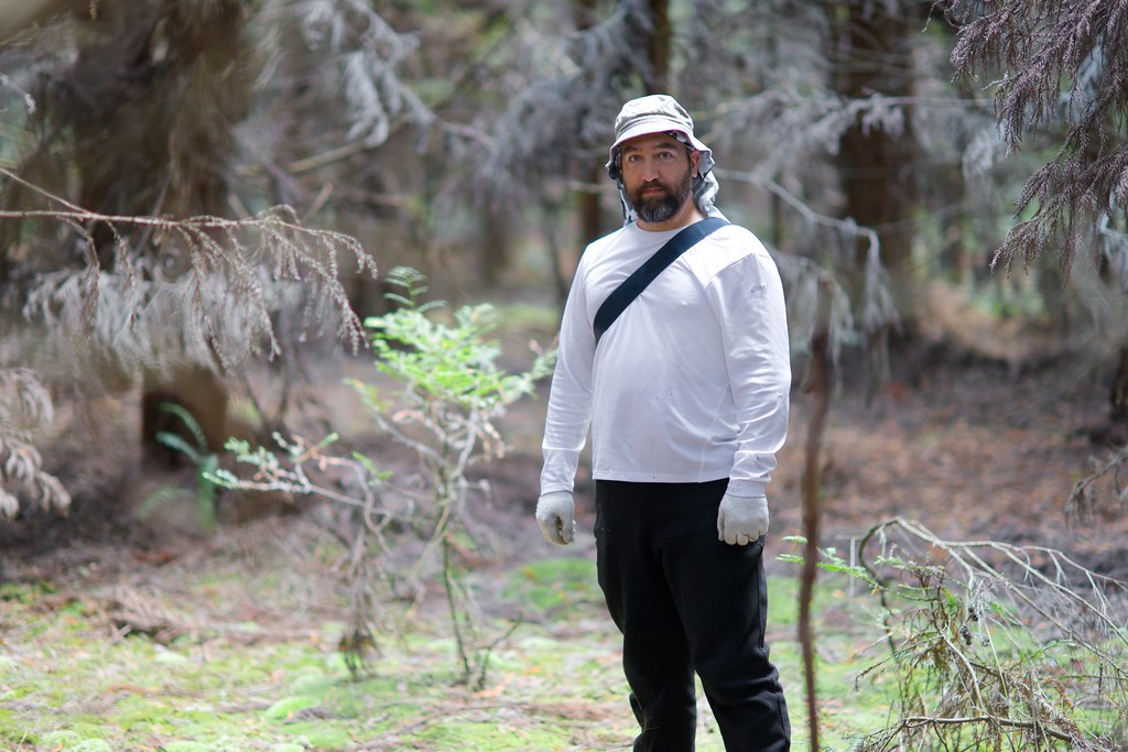
Tired and unwashed, but having an excellent adventure!
The clearing turned out to be a parking lot, next to the Lady Knox Geyser gate. The gate was closed and locked since the 10:15am eruption was already long finished, but we weren’t upset – we’d just had our own custom adventure, and were happy to be back on a regular road.
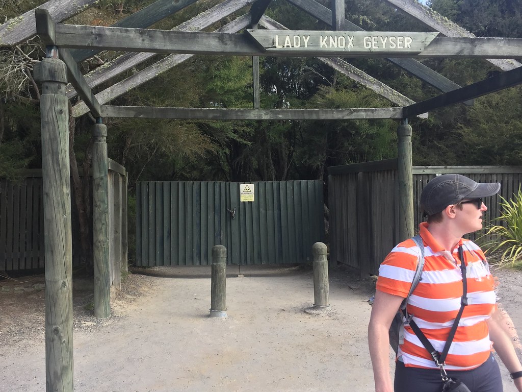
We eventually emerged from the road to a parking lot, next to the Lady Knox Geyser gate. The gate was closed and locked, however, since the 10:15am eruption was already long finished.
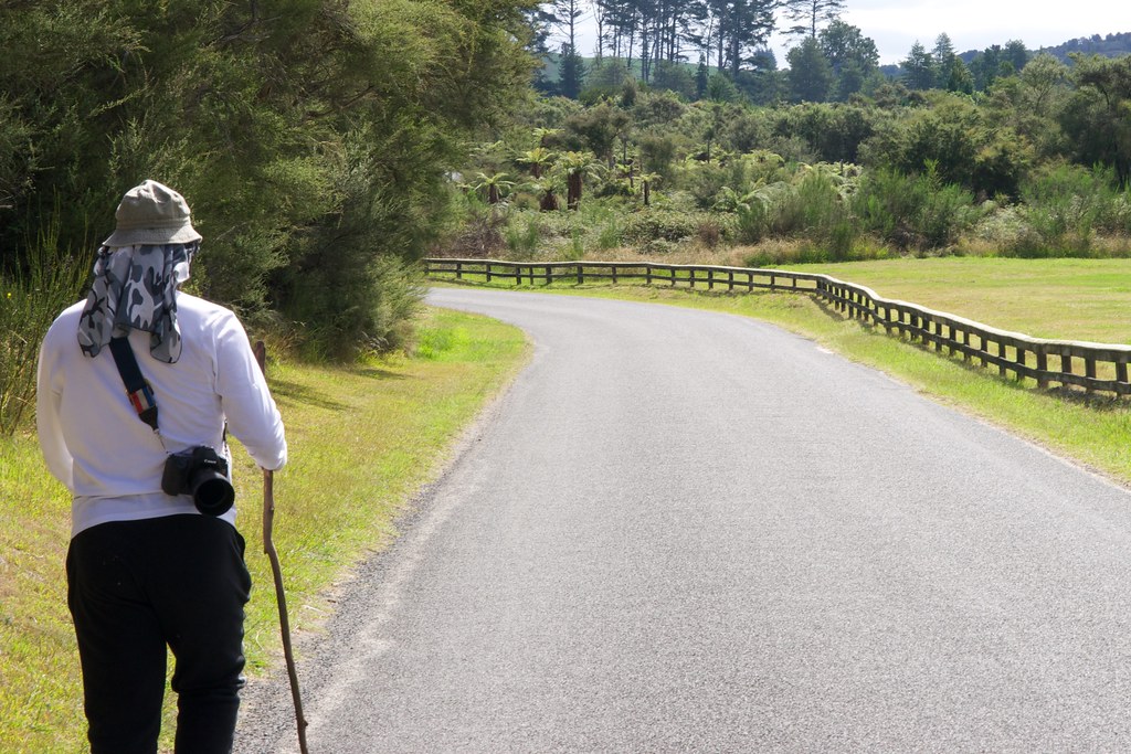
Walkin' with mah stick!
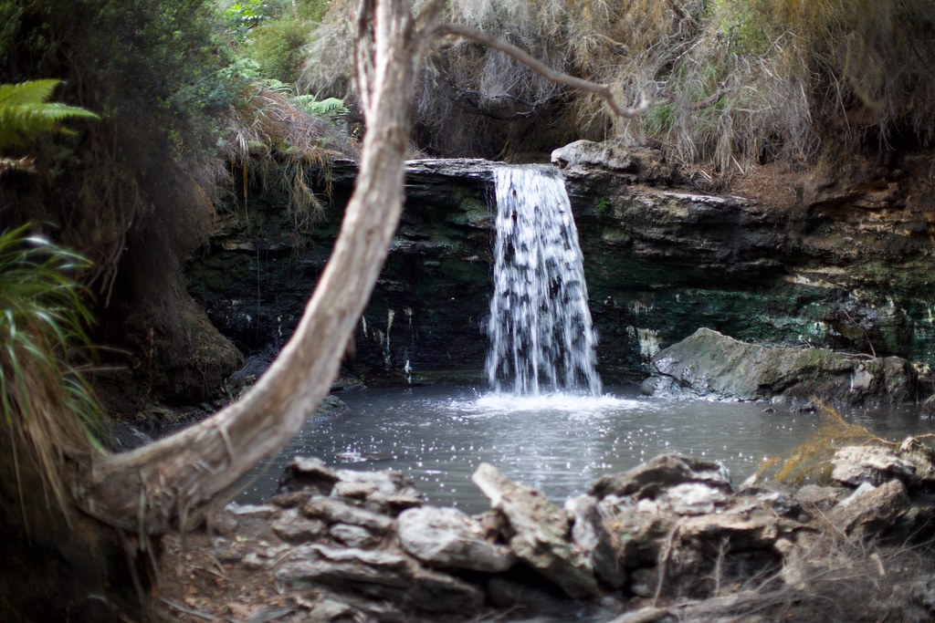
Of course, it wasn’t 10 minutes later that we found a path leading back into the woods, and went off-road again. This time the path led to an adorable little waterfall, and a very emphatic warning sign:
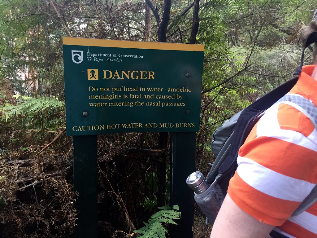
No problem, yo. Neither of us had swimming gear, and neither of us felt like swimming anyway. But we did take a bunch of pictures. Later on at home I was struck by the suspicious resemblance to Patrick O’Hearn’s “So Flows The Current” album cover. Gotta be a coincidence.


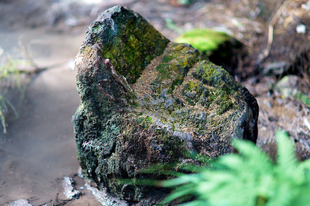
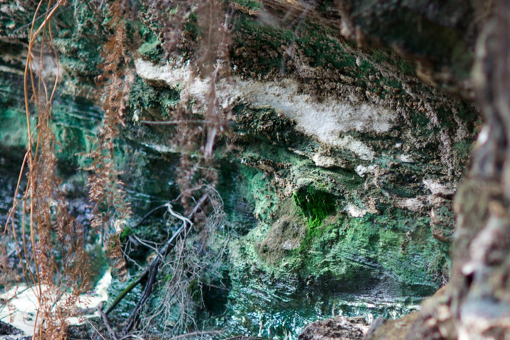
The hot water seeping through the porous rock created some gorgeous lichen formations. Or is that moss? Or some kind of algae? I don’t even know!
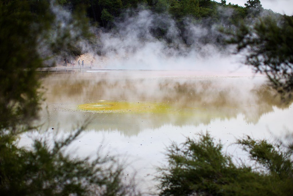
You might think we’d seen enough for one day, but there was still plenty more to go, for a little farther down the road we entered the official Waiotapu Thermal Wonderland area!
Plenty of colorful things to see here:
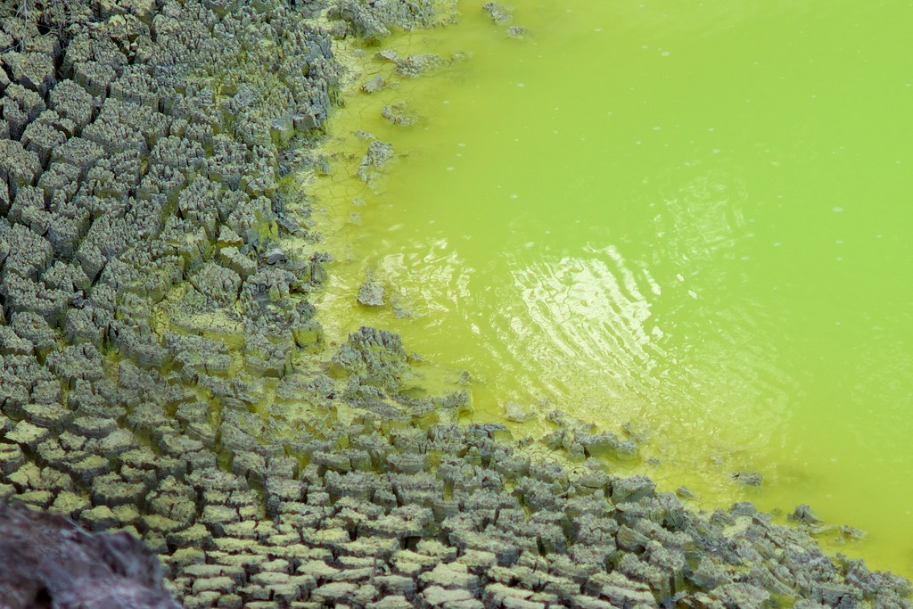
Not actually called "Gatorade Lake", but it might as well be.
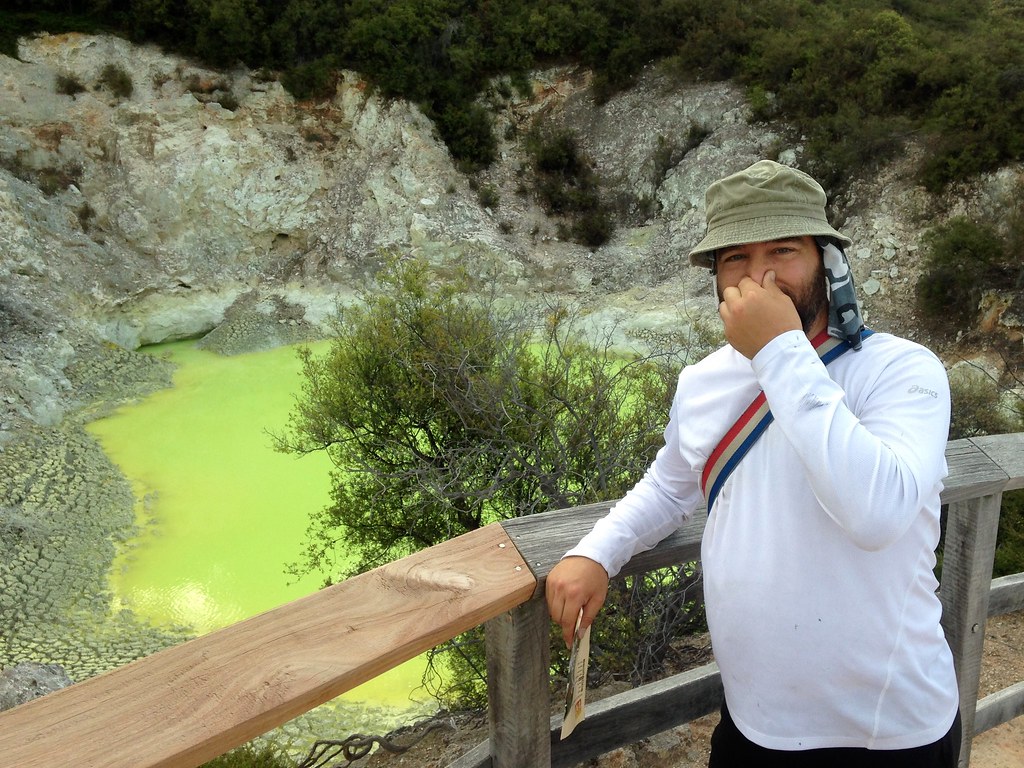
The smell was intense!
And the more colorful, the more stinky!
Refined collections of what you find around the craters.
This formation is called “The Devil’s Inkpots”, according to the sign nearby:
The Devil's Inkpots, according to the sign.
And this formation is called “The Devil’s Snotty Nasal Regions”:
This is a formation called The Devil's Snotty Nasal Regions. Okay, I made that up.
Okay, I made that one up.
In addition to colorful, things around here are also burning hot, and sometimes there is almost no way to tell the difference between a harmless bubbling stream that you could stick your fingers in, and a seething cauldron that would immediately turn your fingers into cooked sausages.
I like to think that the sign in this picture comes with a little caption, reading, “don’t stick your hand over a gushing vent that’s 100 degrees Celsius you complete moron.”

The sign says "Don't stick your hand over the gushing vents, they're 100 degrees Celsius, you morons."
Here’s a smaller region from the previous photo. Now look at that and tell me: Is it room-temperature? Are those bubbles from some kind of additive in the water, or are they from recent boiling, or both? Wanna step in there and find out?
Since there’s a bit of mystery about what’s what, there are many appropriate captions for these little signs:

These signs are good, but there should be more of them. "Do not cook your eggs in here." "Do not do your laundry in here." "This is not a pet bathing zone." "Do not throw tennis balls in here." "Not suitable as soup, no matter how many onions you dump in." "Standing here will not conceal your lack of deodorant." "The second-degree burns are not worth the facebook photo." "There is no P in our Sulhur Sring. Let's keep it that way."
- “Do not cook your eggs in here.”
- “Do not do your laundry in here.”
- “This is not a pet bathing zone.”
- “Do not throw tennis balls in here.”
- “No matter how many onions you drop in, this will not become soup.”
- “Standing here will not conceal your lack of deodorant.”
- “The second-degree burns are not worth the facebook post.”
- “There is no P in our Sulhur Sring. Let’s keep it that way.”
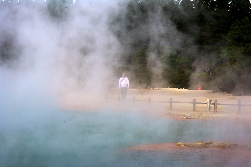
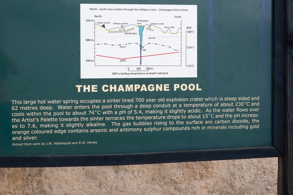
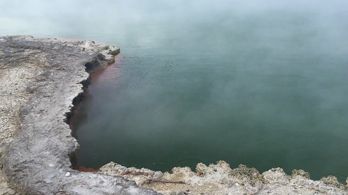
The most visually impressive formation was Champagne Pool, and the overflow area surrounding it.
It looks inviting like a warm bath, but you really really shouldn’t go swimming:
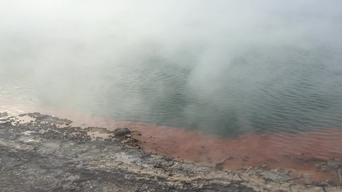
Kerry and I took quite a few photos here, framing things through the steam and catching little details like the crystals growing around the rim:
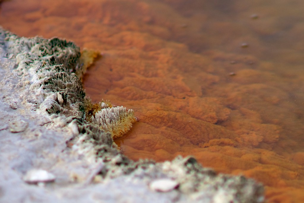
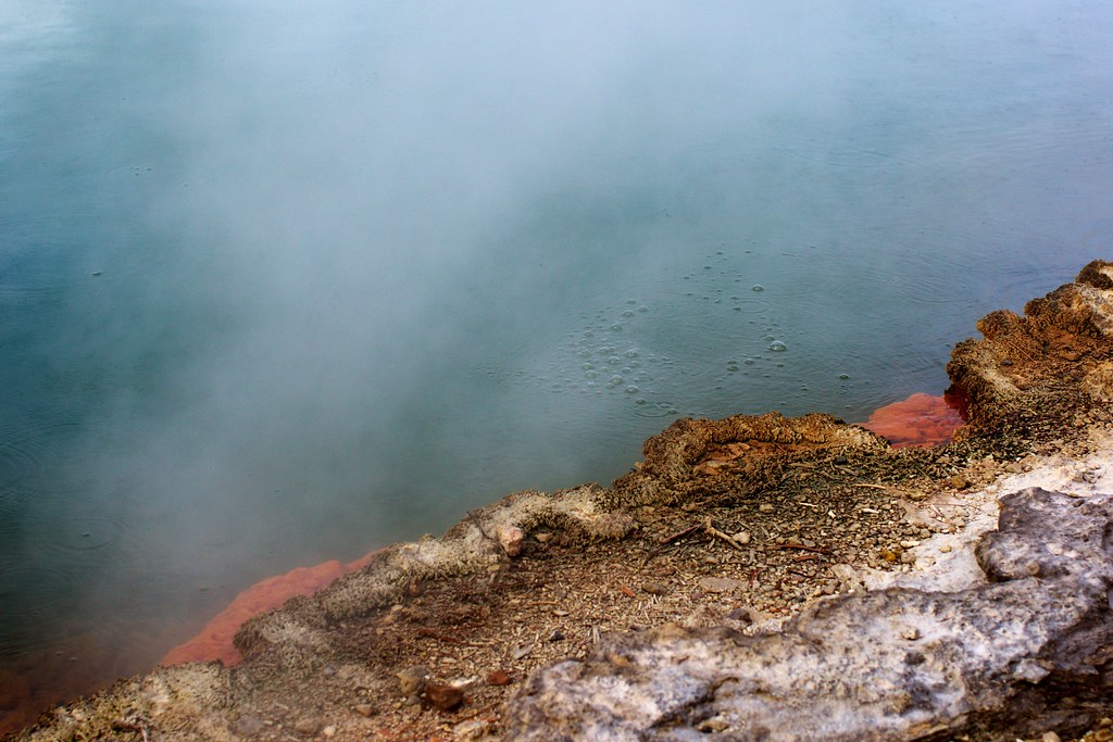
These tiny bubbles are one of the reasons for its name:
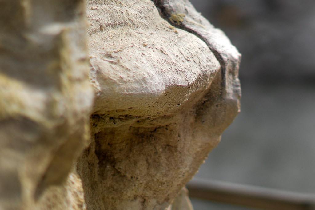
And here’s a close-up of the tafoni-like formations made by the acidic, mineral-rich water trickling down from Champagne Pool, over the mound of sandy rock nearby.
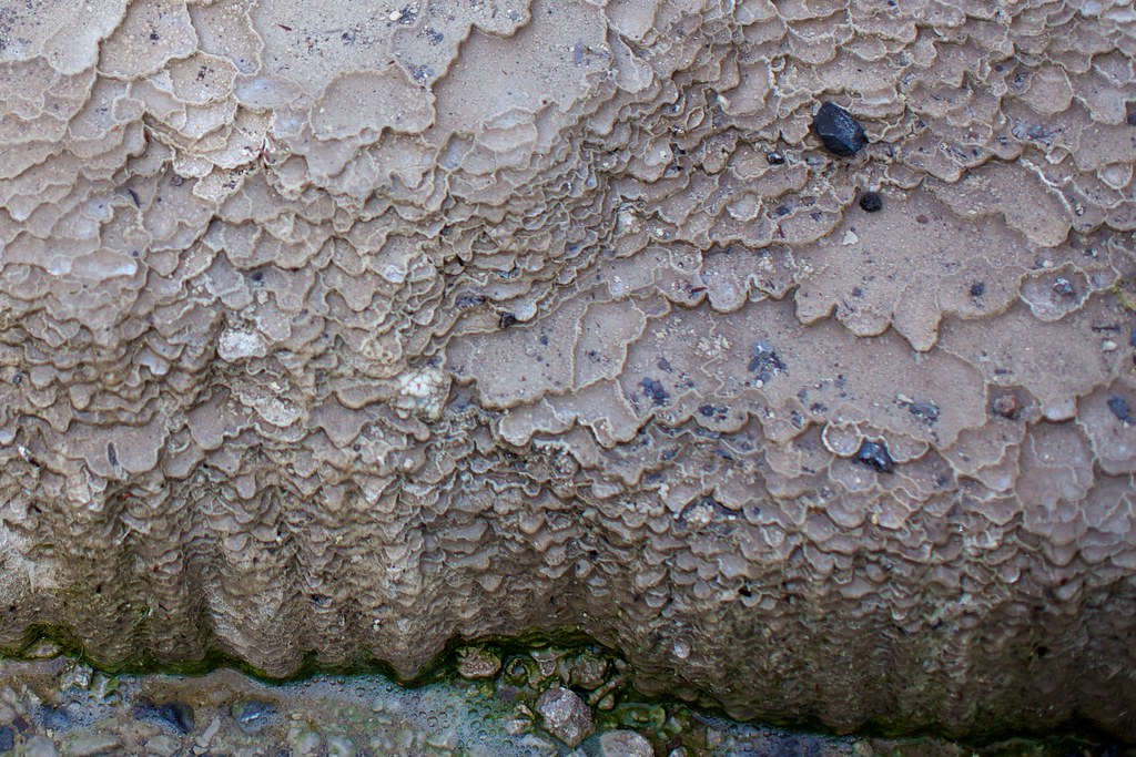
I’m not a geologist, but my current theory is that these form because the acidic water dissolves the material holding the grains together, and when grains come loose they are pushed along by the flow until they accumulate into a barrier, and the barrier is heated by sunlight causing just a little bit of evaporation on the downhill side of the barrier, causing the saturated solution to deposit some of its anchoring material in place, cementing the barrier and making a pool. Then, further flow of acidic water into the pool causes it to deepen, as more anchoring material is dissolved and carried over the rim.
I imagine the physics simulation that would accurately predict this would have to be an extremely accurate one indeed…
An interesting project for future computer programmers, with their much much more powerful future computing platforms!
Besides, I’m too busy right now taking photographs of stuff and going “oooooo!”

Photographs sometimes obscure the scale of things. This is an area about the size of a dining room … but it could also be a hundred square miles of weird geography on some far-flung alien planet in a Ridley Scott film! Woooeeeeeeoooooooo! *boop* *beep*

Photographs sometimes obscure the scale of things. This is an area about the size of a dining room ... but it could also be a hundred square miles of weird geography on some far-flung alien planet in a Ridley Scott film! Woooeeeeeeoooooooo! *boop* *beep*
This looks like the activity of some rude barnyard animal, but it’s actually one of hundreds of sulfurous springs perforating the canyon floor. It’s too small to have an official name, so I’m naming it “The Devil’s Curry Accident”.
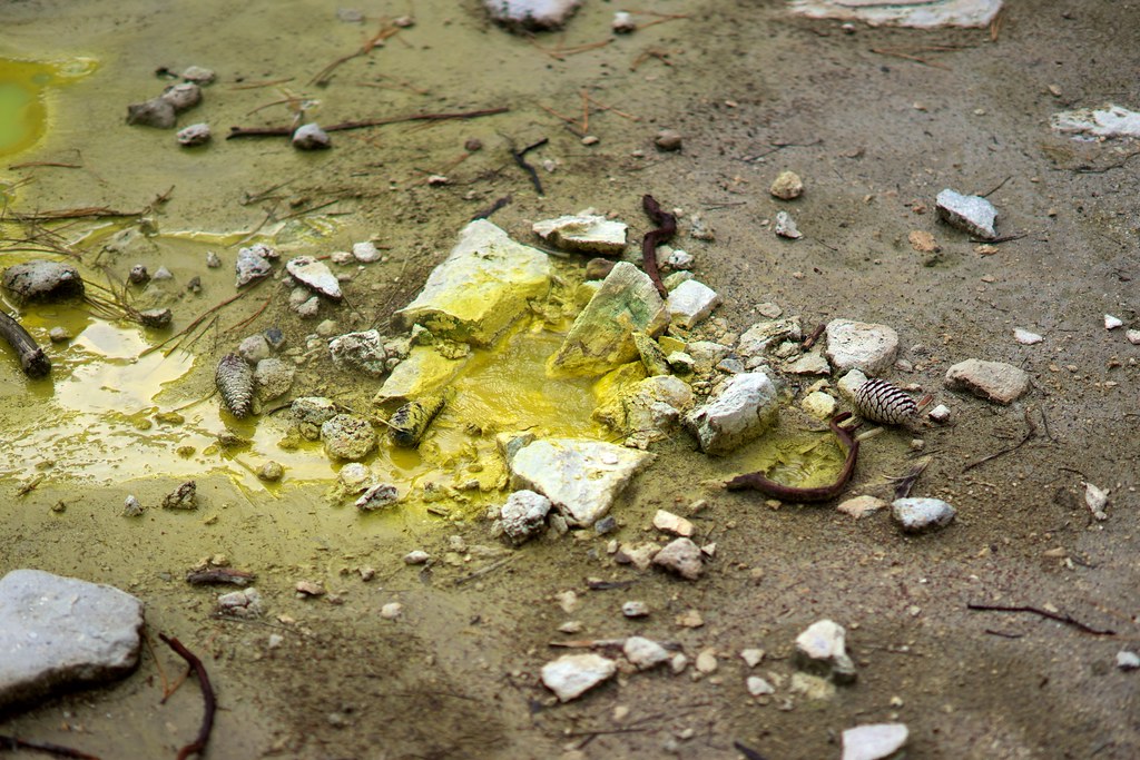
This looks like the activity of some rude barnyard animal, but it's actually one of hundreds of sulfurous springs perforating the canyon floor. This one's too small to have an official name, so I'm naming it The Devil's Curry Incident.
These two formations are called “The Devil’s Nutritional Yeast” and “The Devil’s Suspiciously Old Parmesan Cheese” I think.
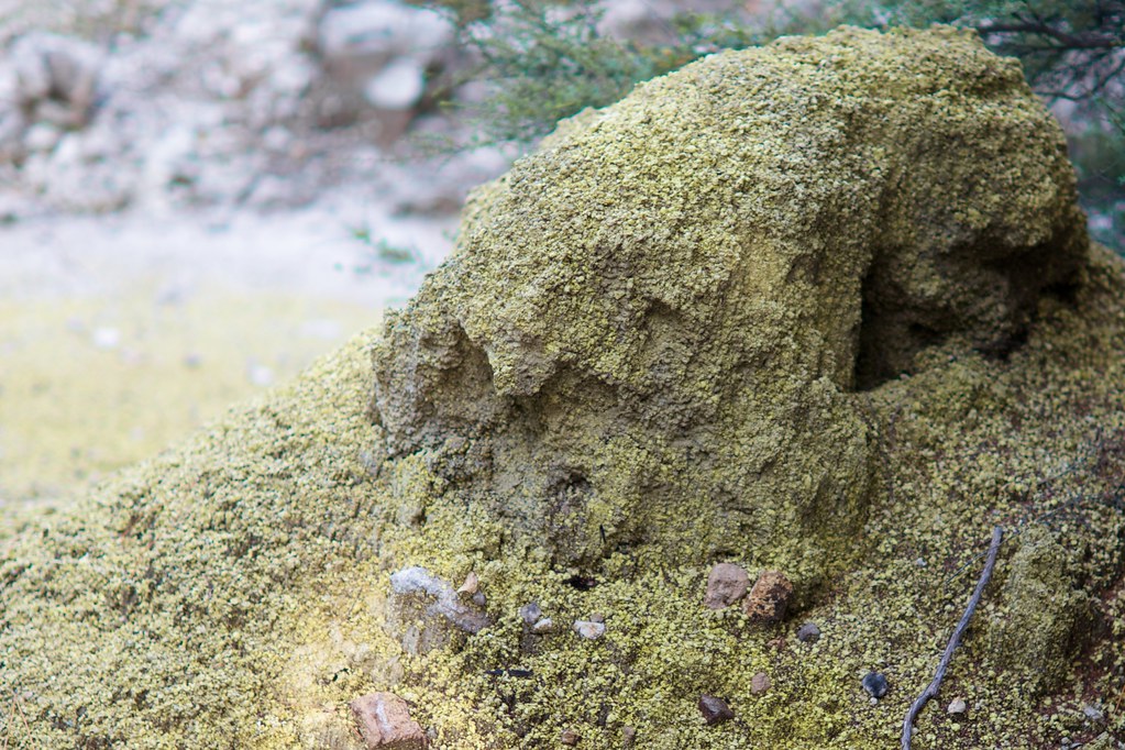
This is called, like, the Devil's Parmesan Cheese Collection, or something.
Pretty sure this spot is called The Devil's Nutritional Yeast.
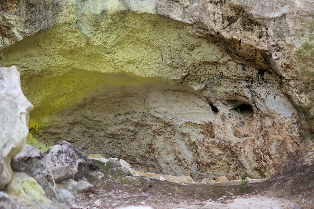
According to the park map, these are hills made of alum. Maybe I’m reading the map wrong, because to me it looks exactly like the chalk rocks I would dig out of the hills back home.
(Kerry’s comment: “Hah! It looks like a butt!!”)
According to the park map, these are hills made of alum. Maybe I'm reading the map wrong, because to me it looks exactly like the chalk rocks I would dig out of the hills back home. Kerry's comment: "Hah! It looks like a butt!!"
True, very true! It was a day full of things that look like butts, or sound like butts, or smell like butts!

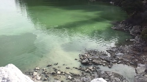
At the very edge of the official park walkway, we stopped to gaze out over Lake Ngakoro, and watch the sediment from the waterfall slowly mix with the more intense colors of the lake:
You can tell from the photo that even after seven hours of hiking, I’m in a good mood!

The walk back to the tavern was long, but damn, what a day.