About ten minutes before the train pulls in, almost all the senior citizens on the train get up, gather their belongings, and file downstairs to wait in line by the doors. It truly is like my Dad says: “They have nothing better to do.”
As Dad is driving me up to Crater Lake, he regales me with some of his Baja stories.
“Did I tell you about the time I almost got robbed by banditos?”
“What? No, you didn’t.”
“Well, I heard stories about how bandits would sometimes line their cars up across the road and just wait for people to come along, and take all their stuff. So I thought I would try and fake them out. I got this little hand-speaker from a radio set, like the police use, and I put a holder for it on the dashboard, and just screwed the wire down under the instrument panel. I figured if I got stopped, I could pretend like I was talking into that and the banditos would think I had backup, and they would get in trouble if they messed with me.”
“That’s pretty silly.”
“Sure, but it worked! I was driving along, and ahead of me I saw a bunch of cars blocking the road, and four or five guys standing around. When I got close I saw a couple of them were wearing scarves and had guns. So I picked up my little handset and pressed the button, and looked at the guys with a very serious expression, and pretended like I was talking to somebody. The guy in the front saw me, and he looked over at his friend, and then he looked over at his other friend, and they talked for a minute, and then one of them got into a car and backed it up, and the guy waved me through.”
“Oh come on! You’re kidding!”
“Nope. Not kidding.”
“Did I tell you about the trip where I had giant tires on the truck? Big old balloon tires?”
“You know, I remember you mentioned it once but I never heard the details.”
“I had these huge tires. They were also very wide.”
“What did you do when a truck came along? Did someone have to go into the ditch?”
“Well there wasn’t usually a ditch but there was a shoulder. One of us – both of us, usually – would just climb up onto the shoulder, and go around.”
“But wasn’t the shoulder a lot rougher than the road? You’d wreck your tires.”
“Oh they would roll over almost anything.”
“How about cactus plants?”
“Well, I steered around those.”
“Get any flats?”
“Oh at least nine or ten.”
“Hahahahaha! You must have spent half your time fixing flats!”
“I got really good at it. I had this jack; very good design. Made it easy. Lift up the truck, take off the wheel, set it down, then lower the axle over the rim, and use it to lever off the tire. Patch the hole, lever it back, raise the axle, put the wheel back on, and drive.”
“You know, this bike trip of yours sounds exciting. If I was younger and had a bike, I’d want to come along with you! … Well, on the other hand, I’d have to look at your itinerary.”
“You can always do what La plans to do, and ride along as a ‘support vehicle’, meeting me at each destination.”
“That’s a good idea. But we’re doing this cruise right now. Maybe on your next trip?”
“Maybe. Ever since I saw that bicyclist doing the Alaskan highway, I’ve wondered if I could try something like that. But I’d definitely want a support vehicle, since some of the hills further up are really nasty. Are you guys interested in a return to Alaska some time?”
“Sure. Let’s talk about it. But we’re booked up for this year…”
We approach the entrance kiosk for the Crater Lake park.
“Huh, looks like they want ten dollars to get in,” I say.
“Oh yeah? Let’s see if my ‘Senior Card’ works.”
Dad digs around in his wallet and comes up with a dog-eared, somewhat blurry card. He holds it out to the woman at the kiosk window.
She waves us in. “Have a good visit!” Dad puts the card away and drives on.
“Well aren’t you Mr. Fancy Pants!” I declare.
Dad arches his eyebrows and sniffs aristocratically. “I know,” he says.
In a parking lot near the rim of Crater Lake, I get out my camera, so Dad gets out his:
Mr. Breakpoint rushes me to the train station Speed Racer style. I walk inside with all my luggage prepared on my back, and my ticket in hand. Of course, that’s when the attendant tells me that the train is running almost an hour late. I should have expected that.
When I get on board, I am seated behind a young man yammering on his cellphone. He stays on it for the next four hours, even switching seats temporarily to plug in and charge. After the first hour, a tough old man with a walking stick and an Army cap boards the train, and is assigned the seat next to me. We both try to sleep. Four or five stops later he gets up and goes wandering around the train. When he comes back, he passes the young man yapping on the phone, and makes a face like, “Duuuh!!” at me. I laugh. We can’t believe he is STILL on the phone.
Since we won’t be getting any sleep, the vet and I start talking. He tells me about the time he spent in Vietnam, doing night-time tank battles. He throws me a bunch of jargon about how they redesigned the tanks over the years to minimize both the exhaust vent from firing, and the muzzle flash. Apparently the muzzle flash at night was so conspicuous that it was easier to target than anything seen during the day. “So of course, the first rule was, fire and then move immediately,” he says.
“That’s funny,” I say, “because there are kids playing computer games today who learned the same tactic.”
“Oh but they don’t learn what it’s really like. Not really.”
“Well, yeah. For one thing, they don’t crap their pants with fear when they hear return fire.”
He laughs. “Well I never crapped my pants, but, I sure paid attention all right.”
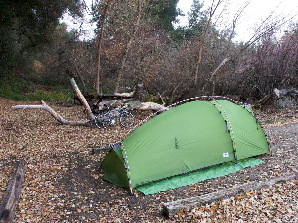
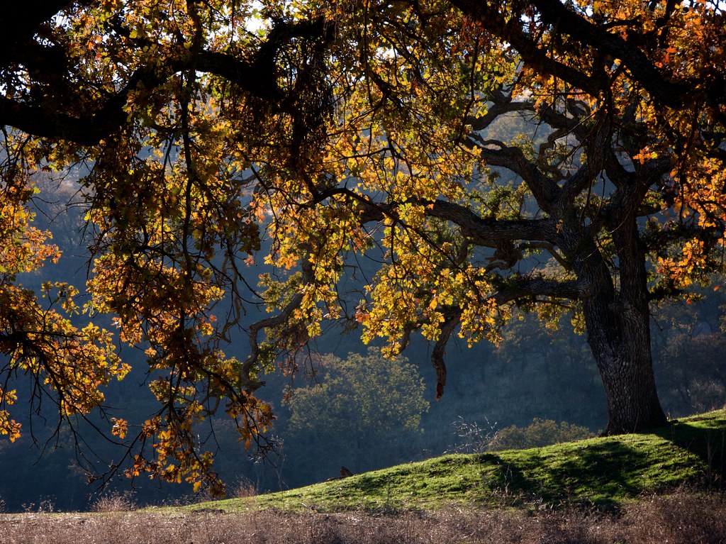
The day before Mother’s Day, I went on a bike ride into the hills. This was the first ride I made with a full complement of touring gear since the Pinnacles Monument ride in January. This time, I packed up a lot more stuff, with the intention of making the trip a lot more comfortable and safe.
On the Pinnacles ride, I had to use both my rear panniers for the tent and sleeping bag, and place everything else in the front panniers. That made the front of the bike very heavy and hard to steer. I didn’t want to make that mistake again.
So I removed the tent from its sack and stuffed it into one front pannier, and the sleeping bag got stuffed into the other front pannier, consuming all the luggage space on the front of the bike. One large item remained: the roll-up mattress. I stuffed that into the sack belonging to the tent, and laid it on the rear rack neatly between the two panniers. I anchored it down with a bungie cord, hooked between the rack and the underside of the seat, and the bag of tent poles hung suspended beneath the bungie cord, crosswise against the rear of the rack, on the back of the bike.
The end result was a lot more compact than I expected. The large panniers were still completely free for food, laundry, and gadgets. So, of course, I completely stuffed them.
Things I took along for this trip that I didn’t open: Three bags of fritos, three packages of peanut-butter crackers, four Odwalla bars, a bag of “energy chews”, and a 20-ounce bottle of mint tea. I also packed two t-shirts I never wore, four pairs of underwear and socks I never put on, a backpack I never wore, a heavy repair kit I never opened, and — through a combination of poor planning and dumb luck — I ended up not needing the tent, the poles, or the stakes. (You can probably guess why.)
Before loading everything into the van, I weighed myself, and then weighed myself again holding the bike. From this I learned two things: One, I’ve gained almost ten pounds since my last major ride. Two, I’ll be pushing 77 pounds of equipment around. (That includes the bike!) That’s exactly 2/5ths my body weight. Good thing I have spare calories to burn.
I took my time preparing, since I had a couple modifications to make to the rack, and some food to cook, and some playlists to load onto the iPhone. I also rode up and down the street with the loaded bike a couple of times, testing the distribution of weight.
By the time I was ready, La was up and about, and it was late afternoon. I whined a bit about the steepness of the hills I would be climbing, and La rolled her eyes and agreed to drop me off partway up the big hill. She’s a really good sport. :)
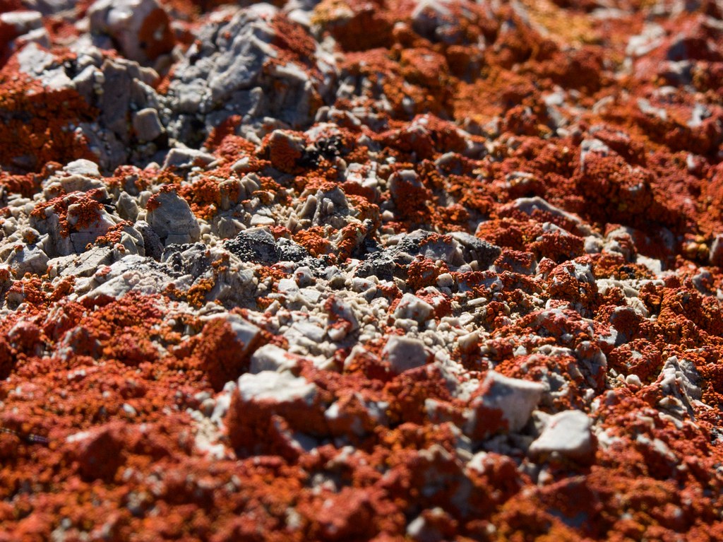
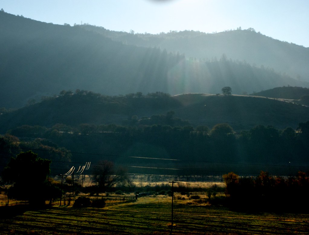
While driving, we had a lively talk about anthropology, and cultural milestones, and adulthood. The terrain became very scenic. We contemplated stopping for a picnic, but before we could make up our minds I spotted an interesting rock formation and we stopped to investigate.
Apparently a tiny stream has been washing layers of chalk down the side of this hill for quite a while. Neat stuff, and only a dozen miles from my office. That surprises me.
La dropped me off about 2/3 of the way up the hill. Before she left she got a few pictures of me test-riding the bike. For the first one, I posed with some Miner’s Lettuce propped on the handlebars. (Miner’s Lettuce is a fragile, primitive-looking plant that grows in these shady forest regions. It’s completely edible, though a bit bland by itself.)
In the second picture, you can see how low the front bags sit compared to the rear bags – it looks ridiculous, and it’s also not very aerodynamic. I may need to purchase a different rack just to cut down on the wind blockage. It would also be nice to have a little platform to stick my camera and snackies on…
I climbed VERY slowly up the hill for the next three hours. My top speed was probably 2.5mph. I had to take frequent rest stops because the muscles in my lower back were in very poor shape, relative to my January ride. Good grief, what has happened over these last four months? Or was it the height of these handlebars, messing with my posture? I really need to get them cut back down.
Anyway, I inched slowly upward. I tried to call my Mom and wish her a happy day-before-Mother’s-Day, but my phone cut off about five minutes into the conversation, and then lost signal entirely. A fire engine came screaming up the road past me, lights flashing. Just after that I began rounding a curve and noticed a road flare, blazing brightly near the center stripe, making a spot of hot pink in a yellow sunbeam. Slowly I pedaled further around the curve, and saw a man in a leather biker outfit, standing by the guardrail next to his motorbike, waving a handkerchief in the air. The road curved again beyond him. Whatever he was trying to warn people about was around the next curve.
I pedaled doggedly towards the biker. A half-dozen cars passed me before I reached him, all slowed down by the flare and the handkerchief. “What’s happening?” I asked him.
“Accident. Guy laid his bike down on a curve.”
Before we could say any more, a troop of harley riders came farting up the road, and stopped near the man. Three bikes, six riders. They all dismounted and began talking excitedly. The guy who had the accident was a member of their gang.
I put my feet back in the pedals and began inching around the next curve. There, parked almost diagonally astride the road, was the fire engine. Just beyond it was an ambulance, with the doors open. Beyond that, a police car. Grim-faced, I pedaled on. In the gap between the ambulance and the fire engine, I looked across the road and saw a crowd of people in uniform, arrayed around a man and a woman sitting dejectedly on the shoulder. The woman was wearing a freshly-installed neck brace. The man was pressing one hand to his head, and his clothes were disheveled as though he’d just finished tumbling around in an industrial clothes-dryer. They were clearly not having a good day. There was no sign of their motorcycle.
Another of their biker friends was standing further up the road, next to a police officer. He noticed me and said, “Easy does it, eh?”
“Two miles an hour, man, all the way up the hill.”
I kept pedaling until I was around the next corner. There, I stopped at a driveway, and stretched my back on the road for a while, and ate some snacks. For all the times I’ve wished terrible punishment on the harley riders and their 3:00 AM farting machines, farting me awake for no good reason on a work night, seeing it up close, even dealt to them impersonally by the road itself, does not bring me any joy.
Frustration, mostly. Bikers know the risks they take more than anyone. Yet they still make bonehead decisions, and then the road chews them up for it. I lost count years ago of all the times I’ve seen bikers do stupid things for the sake of a car length in traffic, or ten seconds less commute time on the open road. I get ahead of myself here, but on the way back from Santa Cruz in the van the next day, I was passed by an enormous man on a harley, weaving his way through the middle of two packed lanes, wearing a bright orange shirt that read, “CAN YOU SEE ME NOW ASSHOLE?”
Two seconds thought; just one thought after your first thought of “Ha, that’s my attitude”, to the next thought: “Will these words make me less likely of a target for abuse? Or MORE?” Nope. The second thought either never happens, or is discarded. Perhaps bikers, as a collective, are paying the karmic debt of their worst, when they get mangled by an innocent curve in the road. That would be unfair, but it might explain why the belligerent ones survive more than a few weeks on the open road.
But whatever. If the man in the orange shirt isn’t squished flat by an annoyed trucker, he’ll have a heart attack soon enough, judging by his shape. I don’t have to get involved in any case. Hah.
Where was I… Oh yes. It sucks to see people injured. But we’re all out here because we love the road.
It took another 45 minutes to reach the summit. At the top, I called my Mom again to continue our Mothers’ Day chat. We talked about gardening and movies, and my early life in Scott’s Valley, and the way that raising kids has changed in the culture at large. We reminisced about owning geese, chickens, and ducks. “We had names for all the geese, but the chickens … they just didn’t have enough personality. One chicken seemed like the next. The only one we named was the rooster, Spike. Spike was chicken even for a chicken – whenever anyone entered the corral he would flee to the other end and hide there.”
She also reminded me about how the sandbox I used to play in as a kid eventually got converted into a potato patch. I’d forgotten that. It was nice to have an “a-ha” moment, and see a memory spring into focus: The deep green, angular leaves blooming up out of the wooden enclosure, with a hint of the yellow sand still beneath.
She really made that house into a wonderful place for growing up. It will be hard to follow in her footsteps, though fun trying. Hopefully La and I won’t have to be a two-income family while our children are young, and we can pay proper attention to enjoying their youth. It would be a travesty to have kids only for the sake of putting them in daycare so we can work enough hours to pay for the daycare, and hope that at some future date, we may actually earn the freedom to be with our kids for a span longer than a weekend. That’s some serious Brave New World crap right there, man.
If that is the new American way of life, then the new American way of life is not for me. I will opt out of it. I will have kids when – and if – I am ready to enjoy it. Some people are married to their careers, or their schooling, and see parenthood as a sort of obligation to their future selves. “If we don’t do it now, we’ll be too old.” But people have kids at 19, and at 29, and at 39, and occasionally at 49. The only reason the valid range seems so narrow to Americans is because their families are all ripped apart for the sake of economic mobility and rugged individualism. We pay a dear, dear price for this. Lacking a clan, where young and old alike are always around, we think our clear-cut generations are the norm.
Hrmm, I seem to have stepped on my soapbox again. Stepping down now…
Anyway, Mom and I finished up our chat so I could start zooming down the hill and out of cell range. The rushing wind became cold in the shadow of the trees, so I stopped at an overlook and put my sweater on. I discovered that I was using my brakes a lot less than I expected, even though the bike was much heavier than usual. At the time, my theory was that the low front panniers were creating a whole lot of wind resistance. And, I was sitting higher in the saddle with that handlebar extension. More adjustments to make.
Later on I realized, it may have been that the extra weight of my bike was helping to keep me glued to the road more strongly, making my inertia feel less dangerous.
I cruised down Highway 9 with ease, enjoying the respite from pedaling, until it connected with Highway 236. I was expecting 236 to continue down the hill, but after about 100 yards it leveled off and then began to tilt slowly upwards. After a while it got just as steep as the hill I’d been climbing all afternoon. I hadn’t been expecting this, and as the gloomy dusk gave way to darkness, I realized that I would be arriving far too late at the Big Basin preserve to register for a campsite.
Well, perhaps I could sneak into one? I was too far down this hill to turn back, so I continued along 236, as it tilted up, and up some more. Very occasionally a car would rumble past me. Usually I just pedaled along into the white halo of my headlight, listening to my ambient music, and hearing the occasional animal noise from the woods.
After a while I stopped and checked my iPhone map. The GPS put me about halfway along 236, between the junction with 9 and the intersection with China Grade Road. Out of curiosity I explored the map around China Grade, in case it offered a better route than my current one, but it squiggled way up north towards Portola State Park and then disappeared. No help there. I looked around me and realized that I could see stark shadows, and turned around in my seat to see a huge orange moon glaring at my back from between the trees, like Sauron’s eye.
I felt a bit spooked, but decided that it was best to soldier on. With my bike in the lowest possible gear, my progress was painfully slow, and I began to regret packing so much luggage. But what could I have left out? As I spun the pedals I went over my packing list in my head, and realized that the only thing I considered “extra” was the food. The gear I was pedaling with was the exact set of gear I would be using on my extended trip in July. It was also the equivalent of what I took with me to Pinnacles at the beginning of the year. Why did it feel so much heavier now?
I stopped, and considered my surroundings. “Well, one thing’s for sure, there won’t be any damn hills like this on the route I’ve chosen,” I said out loud to myself. That’s one of the things you start doing, on midnight bike trips in the woods: You start thinking out loud. It helps to scare away the mountain lions, right?
“And there was one big hill on the way to Pinnacles that was almost the equivalent of this, and it slowed me way the hell down just like this hill does. And back then I didn’t even have this ultra-low gear. Also, this hill is twice as long. Perhaps all this weight will be okay when I get to flatter land.”
It was an encouraging thought, but it wouldn’t help me now. I was looking at several miles of steep hills in any direction. I considered just pulling out into the woods and trying to set the tent up in a clearing, but my chances of finding a clearing were low.
Frustrated, I pedaled onward. Just my luck that I would live in a region where the only accessible forests, the only fresh land for an enjoyable ride, would be laid across punishingly steep hills.
A car blazed past me, on its way down. From the driver’s side window, I heard a man’s voice yell something that sounded like, “harfhl hrraarff hlarrrfh!” Whatever, dude. Just after that, the hill finally leveled out, dropped a bit, and then went on a long level course as it snaked across the hill. I got up to a good 17 miles per hour, then hit an incline just long enough to stall me out at the top and force me to gear way down again. I paused there, to drink a bit of water and munch some chocolate, and in the distance I heard a young woman’s voice laughing and shouting. Campers in the park? Was I that close to the park already?
I checked the map: No, I still had several miles left. Perhaps it was just a house nearby. I shrugged and pedaled down the crest of the hill, then began coasting. After a few minutes of rushing air, I passed by a rocky outcrop and the forest opened, allowing the moonlight to illuminate the road. There, up ahead, was a large sign announcing the entrance to Big Basin Redwoods State Park.
Just beyond that, China Grade Road came swooping down from the north and cut a sloping intersection into 236. It seemed to mark a change in the roadway: Past China Grade, highway 236 began to twist and curve downward with more intensity. I pedaled through the intersection and onward, hoping that the uphill section of my tour was finally finished.
I got up to about 20 miles per hour and then the road made a series of stair-steps, dropping and then leveling out repeatedly. The trees had become irregular, and I could see bush-covered hillside above and below me. The air became much colder, and started to bite, and I regretted not packing my sweatpants. But then an interesting thing happened. I began to pass clumps of trees on my left, and every time I did so, I would hit a wall of air, luxuriously warm and humid. It was as though the trees were buffering the air from earlier in the day, which had accumulated as the sunlight cooked the road. I began to anticipate these columns of air, and breathe deeply as I passed into each one. Aaaaah.
Eventually I plunged down a final stair-step and entered the forest again. This time it was even darker than before. The moon couldn’t penetrate the canopy of the tall redwoods in the park. I continued in rushing silence, taking note of the signs announcing the approach of the Visitor’s Center. I saw a few lit campgrounds in the distance off to my left, but found no driveways leading to them. They must have been on some other road.
At long last I rolled up to the big wooden lodge of the Visitor’s Center. No one was on duty. Behind the clerk’s window I saw a hand-lettered sign, propped on a chair, declaring that three of the five campgrounds were booked, and could not accept walk-ins. “Alright, well that leaves two campsites, maybe I’ll get lucky after all,” I thought, and pedaled on.
No. I rode past the three sites that were full, and then encountered a large, permanent-looking sign at the fourth: “Under construction. Closed for the season.” The sign was mounted on a barred gate, sealed with a padlock. The padlock hadn’t been disturbed for some time.
“Faaan-tastic,” I muttered to myself, followed by a dozen or so expletives. I pedaled forward for a minute and found a second padlocked gate, with a second sign just like the other one. The last campground, also closed for the season. No sites available. Next time, make a reservation, ya dummy.
I stopped by the gate and propped the bike on its kickstand, and dismounted to stretch my back. Eventually I leaned on one of the gateposts at the edge of my headlight beam, and considered my options. Should I keep riding and try to get to Santa Cruz, and check into a motel? Should I attempt to stealth-camp out in the woods after all? Should I go back to one of the campsites and ask any campers who were still awake if I could share their spot?
I thought about calling someone on the phone for advice, and walked over to the bike to check my phone’s signal strength. Zero, as I expected. There never seems to be any coverage in National Parks, … perhaps by design? Is there some legal problem putting cell towers in here? Perhaps an environmental one, with laying the cables…
I looked up towards the gate that I’d been leaning against, and noticed a building beyond it, dimly visible from my bike. I unsnapped my phone from its mount, cranked the brightness way up, and held it out as a flashlight as I walked over to inspect the structure. It had four doors, two of which were unlocked. A large bathroom and a set of showers. The power was off, so the motion-activated lights didn’t engage. The bathroom had a suspiciously clean smell, as though it hadn’t been used for many months. I flushed the toilet out of curiosity. It was in working order.
I turned around and tried the lock-button on the door. It engaged with no trouble and immobilized the outside handle.
“Well whaddaya know. It’s like my own little personal motel room.”
The bathroom was large. I went out to the road and fetched my bike, and wheeled it into the room, and locked the door. I set my iPhone on the washbasin for some light, and started some piano music playing out the tiny speaker while I set up my bed.
The mattress and the sleeping bag were both quite comfortable. I laid out some fresh laundry, drank some water, stuffed my sweater into the pillow-sack of the sleeping bag, and set an alarm for 6:00am. I would get less than six hours of sleep, but I was OK with that. I was feeling paranoid about being discovered by rangers or construction crew and having to explain myself.
Yep: I slept in a bathroom. High adventure this isn’t, folks.
I kept the water nearby, since I was used to sleeping in the San Jose air and waking up parched. But when I woke up at 5:30am, I wasn’t thirsty, thanks to the humid coastal air. It was the first time I’d experienced that in at least a year. I’d been missing it.
I packed my things back onto the bike, washed my face (cold water, yuck) and used the toilet. It was right there, so … why not. Outside, the forest was just starting to brighten into dawn. I took some time to eat breakfast and mosey around the campground that had been closed for “construction”. No sign of any construction, or any construction workers, or any rangers. I could have probably set up in one of these camp sites just fine. Oh well.
I hauled out my iPod and began playing a spooky collection of soundtrack music by James Newton Howard, and started pedaling up through the lush forest towards the south entrance of the park. The steeply angled morning light made the trees glow fantastically, and I wished, not for the first time, that I could just spend all week riding through woods like these, perhaps stopping at bed-and-breakfast cabins so I didn’t have to haul so much gear… Well, some time in the future, perhaps. When I have more money.
33 years old, camping overnight in Big Basin Redwoods, California.
Between the bathrooms and the park entrance I passed by one other person: A tall, scruffy man walking down the road with a huge backpack, carrying a long curved pole wrapped in insulation and tape. He didn’t nod hello as I passed him by. What was he carrying? It was far too long to be a rifle, and if it was a longbow it was un-strung, which would be useless. If it was a fishing rod I don’t know why he would wrap it – perhaps to conceal it from rangers? But where would he fish, around here? The fishing here is extremely poor.
Oh well, it would have to remain a mystery. I left him behind and pedaled out of the park.
A while after that I stopped for a drink and discovered that I was standing about six feet away from a young deer, quietly munching greens by the roadside. I had to make noises at her to get her attention long enough for a face-to-face picture. She seemed quite calm. You can see a bonus banana slug in the first picture.
A while after that I noticed that my phone was getting signal bars, so I stopped and took off my sweater, ate some chocolate, and called La on the phone to tell her where I was. She’d been napping, but she was glad to hear from me. We chatted for a while, then I continued my slow slog up the hill, and eventually the road leveled off just in time for me to see a sign for “Little Basin Road: Rough Road: No Outlet” on my right.
I stopped and checked my map. Yes, Little Basin was the road I was supposed to be taking in order to get to Bonnie Doon, but if this sign was to be believed, the road would be impassable. Well never mind that then. I’ll just stay on this road, and ride to Santa Cruz via Felton. I browsed my map a bit more, until I realized I was hearing a strange noise: A bird call, repeating, going “aww-WAAH, aww-WAAAAAH”, quite loudly.
I turned to my left and saw a house surrounded by a series of wire fences and squares of grass. That explains it. Someone’s running a peacock farm here. I scanned the grass and saw a couple of the birds, long and low to the ground, dark tails folded up and dragging behind them. They sure are noisy in the morning. Maybe it’s feeding time.
A couple of cheerful cyclists passed me, going towards Big Basin. “Mornin’,” they called out, and raised a hand. We’re all glad to be out here, and we’re pretty smug about it sometimes. Heh heh.
The road turned downhill from that point on, and became steep enough that I had to apply my brakes on the curves. I stopped at the top of a particularly scary one and got out my camera, and stuck it on the handlebars in movie mode, so I could make a film clip of my descent. The camera only takes movies in 60-second bursts, though, and after the minute expired I had to come to a complete stop to put the camera back in my luggage.
After my second attempt at a movie, I was packing the camera back into my rear pannier, and I looked up and saw a large hand-painted sign announcing the presence of a Buddhist Retreat. Beyond the sign, up the hillside a ways, I saw the turret of a bizarre structure. I wheeled my bike up the hill and took out my camera for a photo.
While I was standing there, a woman came walking out of the house nearby and said hello. She was years older than I, but very pretty, with simple clothing, short grey hair, and a kind face. I struck up a conversation with her about the Temple, and she told me about the founder – a wealthy professor from San Francisco, I think – and the monks they had transported from Nepal to act as cultural emissaries and lead meditations. I told her I was very glad to see such a place, because I found the strong Christian presence to be … tiresome. She seemed encouraged by this and invited me to attend an open-house that they would be having in July – the 14th, I think. There would be music, free food, and tours. I made a mental note to tell La and Kashy about it. Then I politely said goodbye and walked my bike respectfully off the property … since I was obviously trespassing, after all.
The road squiggled quickly down towards Boulder Creek. I passed a golf course, with a bunch of people zipping around in little motorized carts. A few of them waved at me. I took out my camera for a photo of some trees and noticed that the card was full, so I stopped at the side of the road to import the photos into the laptop and clear up some space.
Then it was more downhill, through a stunning avalanche of green, plants and bushes and trees, seething at the edges of the road, eating up the rough, earthy hillside, sparkling with water and pillars of light. I’d forgotten how lush and alive this place was.
I would have to get on a plane and fly a thousand miles in any direction to find something more lush as this, possibly on an island out in the Gulf of Mexico, or up along the misty coastline of Washington. And that would be without the redwoods, of course. There’s nothing like them anywhere else in the world. It sucks to live just beyond reach of all this, down in central San Jose. It sucks worse than living entirely apart from it, I think.
Eventually I reached Felton, and stopped in a park near the middle of town, to arrange my gear and eat more snacks. I called The La and asked if she would mind picking me up here. She said yes, so I walked around the park and bided my time.
I did some people-watching, and inspected a covered bridge. I passed by a young woman in goth dress reading a book beneath a tree, and did a double-take. She was the spitting image of Carolyn, but I knew it couldn’t actually be her, unless she had managed to age about a year backwards in the intervening seven years since I last saw her. I stopped under another tree a respectable distance away and listened to a podcast, and noticed a creepy-looking guy carrying a plastic sack and wearing leather work-gloves. He was walking around the park, on the cement pathway, in a figure-8, over and over. I watched him curiously until my vision was interrupted by a jaunty black labrador, sopping wet, who ran over to a bush near the park entrance, sniffed it, and peed on it voluminously. There seemed to be no end to his pee; I suspect he just about killed the bush outright.
The traffic turned out to be horrendous. Among other things, La passed by a car that was ON FIRE as she threaded through the beach traffic over highway 17. She is a brave soul. Eventually she rolled into the lot near the park, and my second overnight “camping” adventure of the year came to an end.
Google maps is amazing. But Google Earth is even more amazing. A huge chunk of SF has been modeled in 3D, to match the textured contours of the geography. It must have taken a lot of work.
If you place the viewing camera in the right spots, you can see all the artificial bends and curves in the building textures line up. When that happens, you’re looking at the textures from where the surveyors took their high-resolution photographs. By noting the exact location and angle of the photograph, programmers used a kind of reverse-raytracing process to map the textures visible in the photograph onto the sides of the 3D models in Google Earth.
The new bike bags, purchased from a German company called Ortleib, are much roomier than my old ones, and they stay attached to the new rack much more securely.
In these two bags I have:
My USB battery pack
A bike pump
Some hex wrenches
A spare tube
Tire levers (for removing a tire easily to replace a tube)
A test ride around the parking lot. Looking at this, the first thing I notice is all the dark clothing. Shouldn’t cyclists wear lots of neon and corporate logos to catch the eye? I don’t know, really… As a driver, most of the time when I notice cyclists it’s because they’re moving. Sure they’ve got bright clothing, but outside, everything’s bright. And when I notice cyclists at night, it’s not because they’re wearing a neon shirt, it’s because they’re generating light, and have highly reflective patches that stand out like highway markers. So, I don’t know… Does the bright clothing really make a difference??
Also, the helmet: I’ve always figured that a white helmet is better for cyclists because they’re usually interested in keeping their head cool, and white would reflect more sun. But some geek on the internet performed an experiment with a bunch of plastic heads, sun lamps, and temperature sensors, and found that the difference between the increase-over-time in temperatures was so slight that it didn’t even make it out of the “statistical error” bars for his measuring instruments. Truly you can find anything on the internet.
Still, next helmet I buy is gonna be a white one, because I like white. :)
Just after taking this picture, I saw a crowd of young cyclists coast into the lot and swirl around for a while. One of them was a slim, freckly redheaded girl in a green t-shirt. One of them was a suave looking guy with a dark coat and black hair, who looked a lot like the actor Billy Crudup. One of them was a tall fellow in a red felt windbreaker, with red crocs (bulky plastic shoes) and a red bicycle frame. (All color coordinated!) I put my camera away and started riding along behind and within their group, doing what they did. They moved in and out of traffic, and on and off sidewalks, with practiced ease. It was quite thrilling. Made me wish I had a video camera.
I’d love to do it again but I’d be way too scared to try it alone.
The guy who tricked out this bike was standing nearby taking photos of it. He said this was his second piece. His first one had, among all the other chrome doodads, a chrome frame. “That must have been beautiful!” I said. “Yeah, but it took four hours to clean after a ride,” he said.
There’s a reason all these pictures are scaled down so far. They’re incredibly grainy. Almost all the pictures I take today, with this six-year-old camera, are grainy. Every time I zoom in on these with Aperture I get depressed because I could have made beautiful prints out of some of these, but they are just destroyed. I shoot in “raw” mode and apply judicious noise and color correction and they still look like sand-sculpted mandala paintings afterwards. Bah!
I really need a new camera, but the one I want is over a thousand dollars. I need to face facts and acknowledge that I’m just a gearhead who is almost never satisfied. At least I have a camera!!
The route I took around the palace. The entrance I used didn’t have any signs warning away cyclists. I noticed plenty of them on the way out though. Sorry people. :D
As I rode along the back I passed by an open area next to one of the exit doors and saw a crowd of 20 or 30 teenagers practicing a hip-hop dance routine. A car pulled up, and one of the kids yelled, “hey, what’s up with that car? Oh wait, that’s my Mom! She brought us lunch, guys!”
Someone very precisely stacked rocks near the shore at the base of the Golden Gate. I have no idea how they did it, but it made for a groovy photo with the skyscrapers in the rear.
I went about halfway out on the bridge, then decided to turn back so it would be easier to meet up with The La. Perhaps some other day I’ll explore Marin like I planned.
Still so many things to see in this beautiful city… One could spend a year scrutinizing just a few city blocks and never run out of history, people, culture… It is absolutely overwhelming.
I inaugurated the new year by doing something that I could never have done one year ago. I got up in the morning at 9:00am, packed a campsite’s worth of gear onto a bike – 75 pounds total – and then rode the bike 83 miles. This, after riding 80 miles over the previous two days!
One year ago I would have said, “83 miles? Ridiculous. Forget it, kid. The people who do that are Olympians. You’d be lucky to get 30 miles a day. Twenty or less if there’s a lot of crap loaded on your bike.”
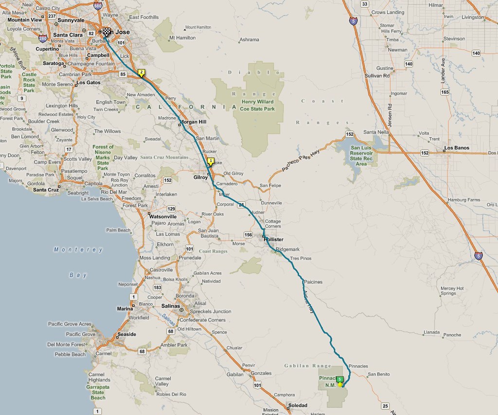
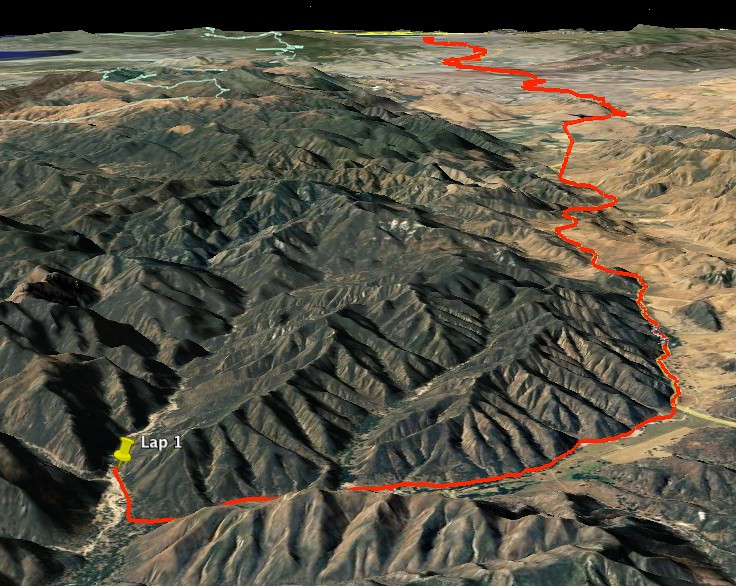
In three days I rode from my house in San Jose to Pinnacles National Monument and back. According to my GPS tracker, I burned close to 10000 calories. And that’s just from the bicycling – so it’s on top of the regular 1700 or so that my body uses just to operate each day.
(The “1” flag you see on the map there is where I stopped for the night at the end of day 1, and where I got french fries on day 3. The “2” is where my GPS ran low on batteries, and I had to stop for a while and connect it to the charging cradle inside my handlebar bag.)
As I type this I’m sitting in the Vegetarian House restaurant, with three main courses in front of me. I’ve already obliterated the “Majestic Mango”, and have the “Ocean Basket” and the “Thai Curry Soup” to go. It’s a good start, since I have six days of calories to make up for…
Now it’s time for some pictures and some lists. Let’s start with a list:
Inane Things That Only Long-Distance Cyclists Care About:
“I want to take a detour on highway [blah] but OMG what if the ROAD IS ALL NOBBLY??” ( Different types of pavement have a different rolling resistance. )
“Gosh, I hope the next town has a small store with big windows.” ( Otherwise I won’t be able to watch my bike while I’m shopping. )
“I hope that fence is strong, because that dog is going to go nuts the second it sees me.” ( Handy tip to potential dog owners: If the breed you’re interested in is too dumb to know the difference between a buffalo and a bicyclist, try a smarter breed, please. )
“Hmmm, I want to get a snack but … how do I find the one with THE MOST calories, that weighs the least?” ( Okay, maybe hikers worry about this too. )
Let’s mix thing up a bit. Here’s an audio recording of the side of the road, made between San Jose and Gilroy. That’s me eating a bag of chips in the foreground.
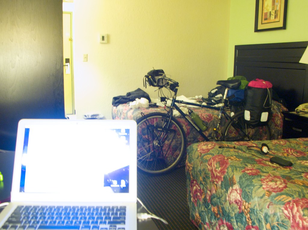
This is the hotel room I stayed in at the end of the first night. It’s the Gilroy Motel 6, and it cost a damn fortune, but on the upside they had an endless supply of hot water.
You can also see the bike. The two front bags have been removed and dumped out on the bedspread, and the food moved to the fridge. That’s about 20 pounds of the 75 pounds total.
Here’s a shot of the bike against a tree. I took a break to pee and change into a long-sleeved shirt. Sketchy operations in the suburbs, man. The USB charger device is packed into that bag on the handlebars.
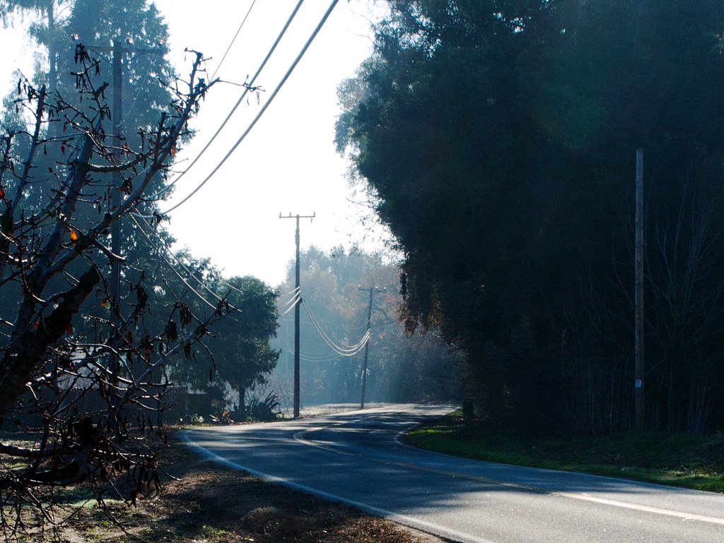
Heading south from Gilroy on day two. The fog makes the road look mysterious.
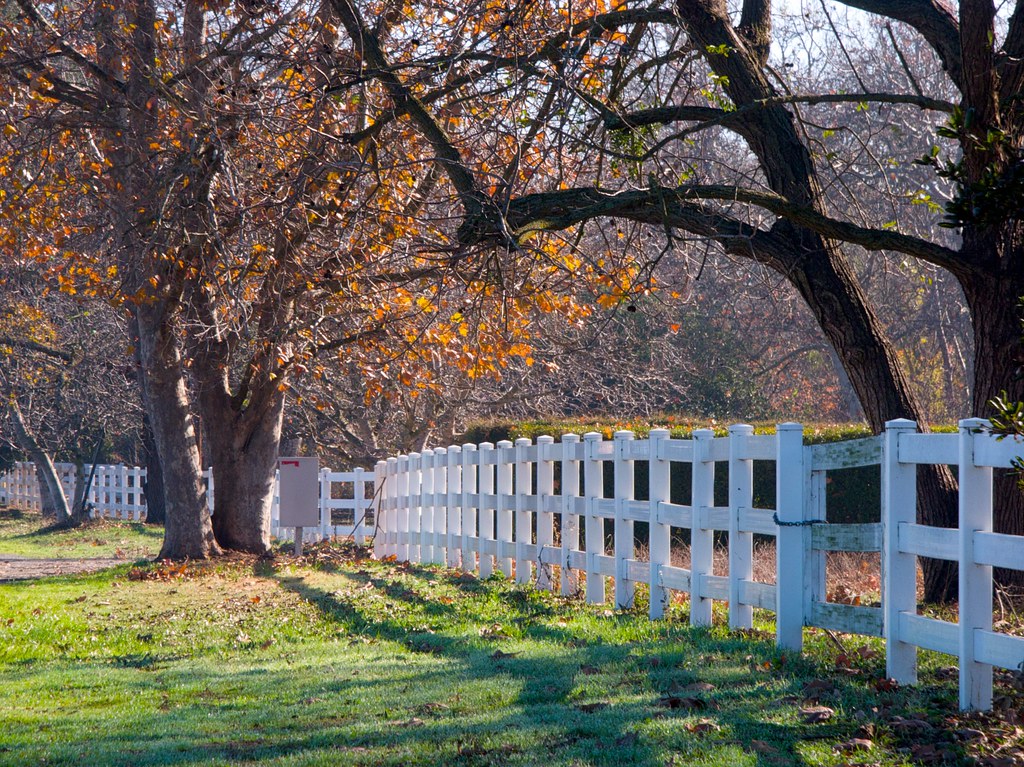
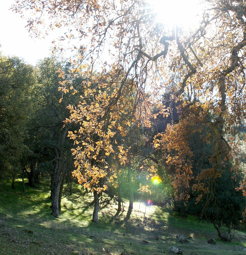
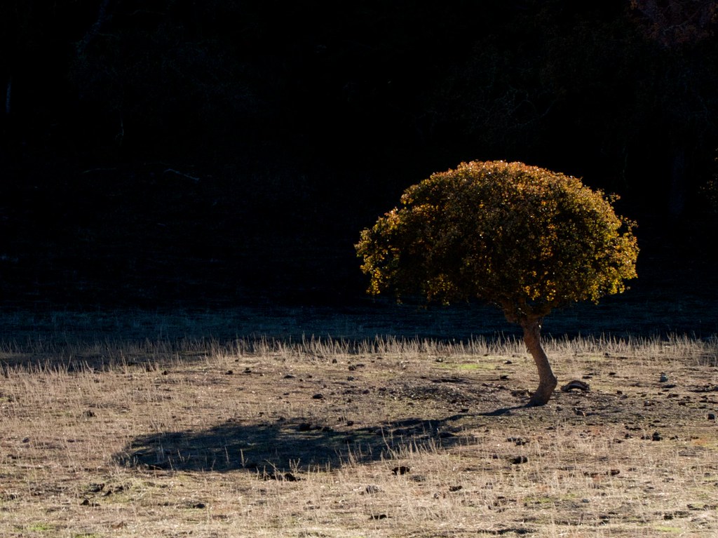
A sturdy white fence and some colorful trees is a classic photograph setting!
A sturdy white fence and some colorful trees make a classic setting.
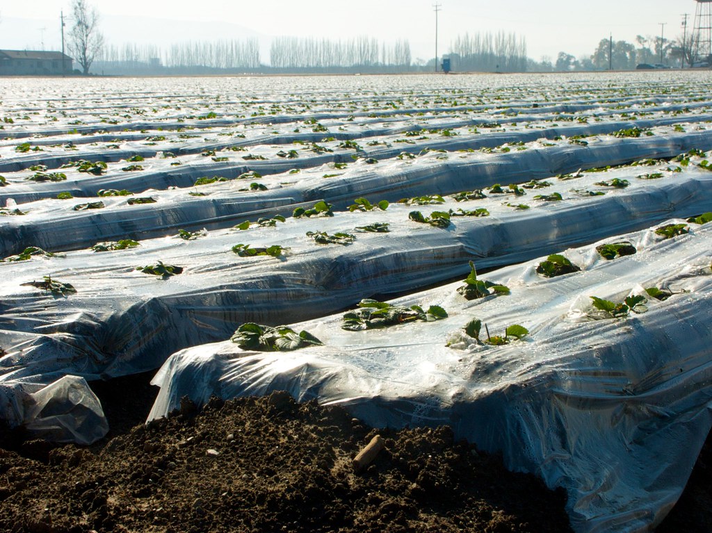
In case you’ve never seen these up close, these are what the plastic rows on all the fields look like. The plastic insulates the soil, greatly enhancing the survival rate of the crops on cold nights.
In case you’ve never seen these up close, these are what the plastic rows on all the fields look like. The plastic insulates the soil, greatly enhancing the survival rate of the crops on cold nights.
In case you’ve never seen these up close, these are what the plastic rows on all the fields look like. The plastic insulates the soil, greatly enhancing the survival rate of the crops on cold nights.
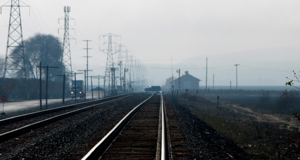
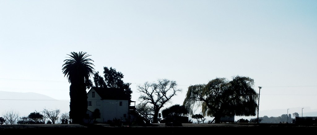
There’s something about silhouettes in mist that reminds me of the otherworlds described in Lewis Carroll books. This probably dates back to my time playing old 2D Windham Classics games on the Apple II.
There’s something about silhouettes in mist that reminds me of the otherworlds described in Lewis Carroll books. This probably dates back to my time playing old 2D Windham Classics games on the Apple II.
There’s something about silhouettes in mist that reminds me of the otherworlds described in Lewis Carroll books. This probably dates back to my time playing old 2D Windham Classics games on the Apple II.
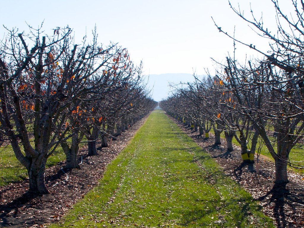
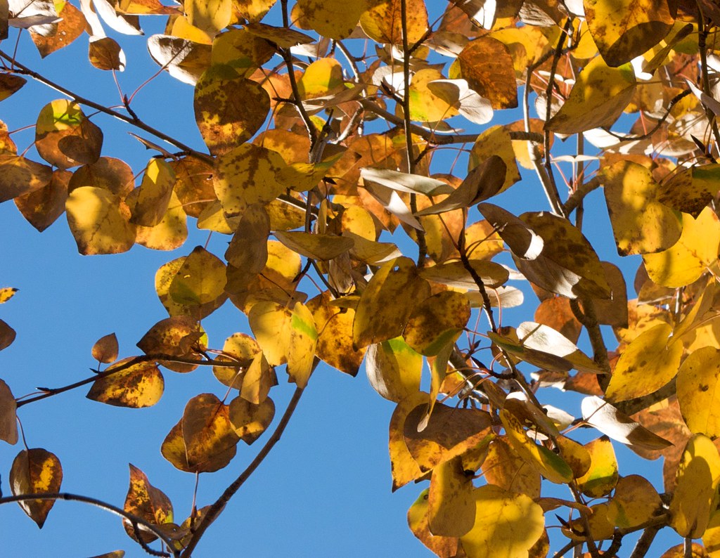
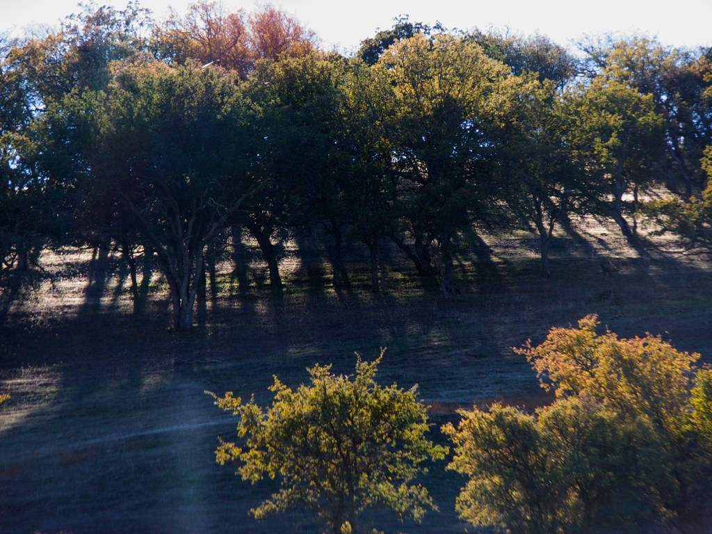
The trees just march off into nothingness. How far would you have to walk before you passed the same suspiciously identical tree?
The trees just march off into nothingness. How far would you have to walk before you passed the same suspiciously identical tree?
Same with shots like this one. The trees just march off into nothingness. How far would you have to walk before you passed the same suspiciously identical tree?
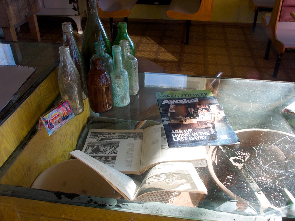
As the towns get smaller, the periodicals get weirder. I don’t think there has been a single day in the history of The Watchtower where the staff didn’t think they were Living In The Last Days.
As the towns get smaller, the periodicals get weirder. I don’t think there has been a single day in the history of The Watchtower where the staff didn’t think they were Living In The Last Days.
As the towns get smaller, the periodicals get weirder. I don’t think there has been a single day in the history of The Watchtower where the staff didn’t think they were Living In The Last Days.
As an aside, I look at a religious magazine like this and all my cynical brain can see is a giant, wriggling tick, sitting there on the countertop. An intellectual parasite. People pick it up and it burrows into them and steals their power, sucking it up for itself, and releases some chemical that makes them feel secure in exchange.
Picture them; the devout, scratching at their ears and eyes because they itch from all the ticks inside. It’s a pretty effective metaphor. Um, anyway, moving on…
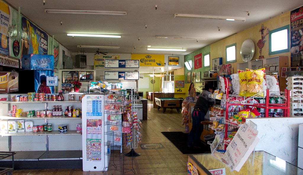
The combination restaurant, pool hall, and general store that I stopped in for a bottled Spanish coke. The salt and pepper shakers were made from the same bottles.
The combination restaurant, pool hall, and general store that I stopped in for a bottled Spanish coke. The salt and pepper shakers were made from the same bottles.
The combination restaurant, pool hall, and general store that I stopped in for a bottled Spanish coke. The salt and pepper shakers were made from the same bottles.
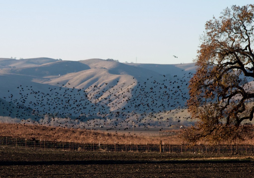
The birds were out to play on the farmland. About this time I began listening to the audiobook of “The Worst Hard Time”, a tale which fit quite nicely with a meditative trip through the country. The book describes the situation of my ancestors only two or three generations ago, surviving the horrendous dust storms of the 1930’s. (For those of you not in the know: Once the farming ecology around Oklahoma and Texas collapsed, the region became a host for dust storms so incredibly enormous that they would roll out all the way across the eastern half of the United States and interfere with ships out in the Atlantic Ocean.)
It occurred to me that despite my valid complaints of not having enough time to do things, I have never had to worry about having the strength left in me to do things. My ancestors had to work so hard their fingers literally bled, in territory so cold it could freeze their eyelids shut at night, sleeping in a dirt house crawling with snakes and spiders, burning cow dung for heat, and they considered that an improvement over the utter destitution and government betrayal that they had left behind in Russia. They sang songs and ate bratwurst and had huge defiant weddings.
Just being out here on a bicycle, in such good health to pedal it, armed with my credit card and guided by my iPhone, is an exercise of immense independence and wealth. It kicks ass. If my ancestors had stayed in Russia, I would probably be the same half-frozen peasant farmer of 100 years ago. I’d just have slightly better glasses and maybe a digital watch, and a lot more dead relatives to mourn.
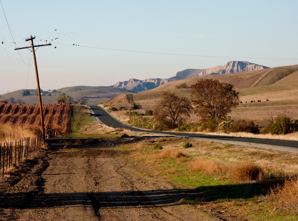
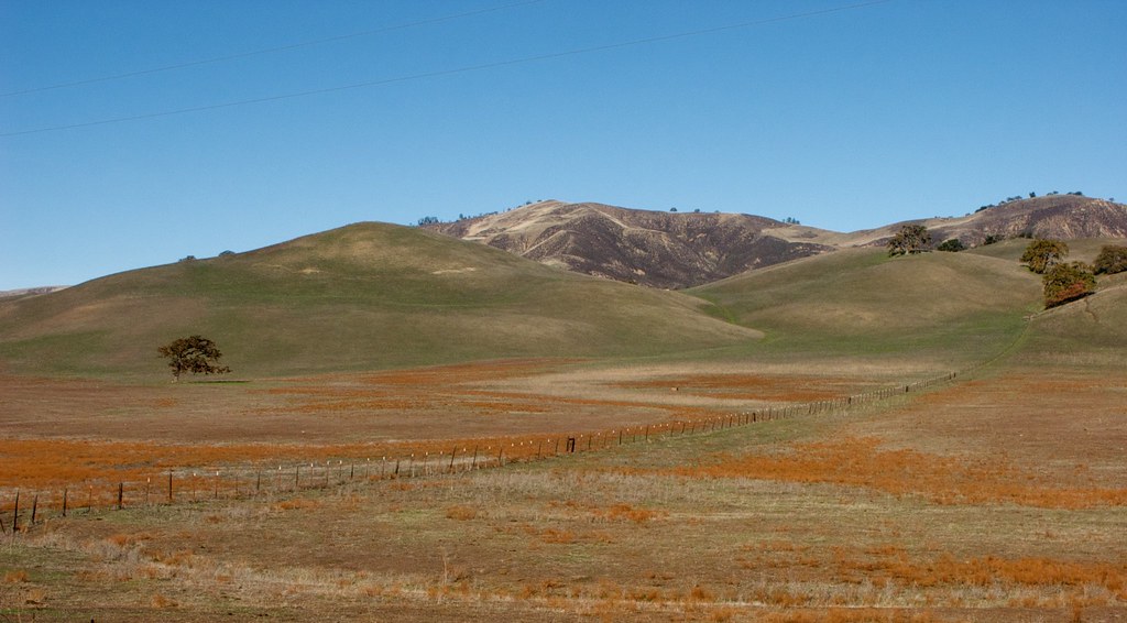
California’s got this nicely varied middle section, where you can get badlands and vineyards in the same shot.
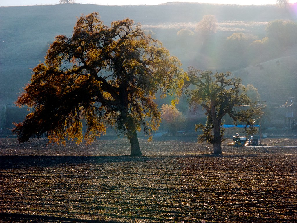
It was getting late, but I still couldn’t help myself with the stopping and the picture taking. Seeing how this shot turned out makes me wish I had a better camera. Of course, a new one would weigh even more than this one — but having a fancy camera to fool around with is so much a part of the adventure, I’d happily accept the extra weight.
Just after this photo I ran into a huge hill, the first really steep one of the trip, and I hadn’t been expecting it. As I pedaled in my lowest gear I passed the time by calling the hill foul names and cursing it under my breath. It was obvious that I wouldn’t make it to Pinnacles before nightfall.
I began to scope out the valleys on either side of the road in case I found a spot suitable for some guerrilla camping. I almost tried it twice, when promising spots presented themselves, but changed my mind at the last minute when I realized I would just spend the entire night worrying with one ear cocked out for murderous wildlife or angry farmhands.
Two or three hours later I finally made it to Pinnacles. This was four hours later than I’d planned. Turns out the final stretch of the route was infested with steep hills – wavy ones all bunched up together that hadn’t shown on the 3D map while I was gauging the distance the previous night. Also, I made a lot more stops than I expected.
TOP TEN REASONS MR. FINS, AMATEUR CYCLIST, WILL STOP
10. Whew! Time to change shirts.
9. Oh boy a general store! Time to get more SNACKS. (I am pwn3d by snacks.)
8. Ugh, this hill is just too steep for too long. Let’s push and walk for a while.
7. Lousy sunglasses, getting all greased up… Time to wipe them off.
6. Okay, now the signals from my bladder are not so subtle. Time to find a tree.
5. Damn, someone’s calling and I’m wearing gloves. Time to stop, take one off, and press the ‘answer’ button.
4. Ding dingg… Snack time!
3. I feel just a tiiiny bit thirsty. I Can’t Be Having With This. Glug glug glug.
2. Look at all the pretty birdies and flowers! Eeee!
1. Oh how lovely; I simply must photograph that! (Technically a tie with #2.)
A chilly night camping at Pinnacles National Monument, California
A chilly night camping at Pinnacles National Monument, California
This is what my campsite looked like in the morning. I decided to pitch the tent in the middle of the driveway, since it was the flattest part of the site. My original plan was to stay here for two days, but the weather made it unbearable. The sleeping bag I brought was just not warm enough. The mattress I brought was also a bit too small for the sleeping bag.
As I tossed around in it trying to bend myself onto the mattress, I was treated to a chorus of critters yowling in the distance. Here, have a recording!
When I trekked over to the manager’s office at 9:45am, they’d posted the temperature measurements from the previous night. Turns out it had dropped to six degrees below freezing.
The projections for the next night were even lower. I wasn’t interested in dealing with that for a second night, so I decided to pack everything right back up.
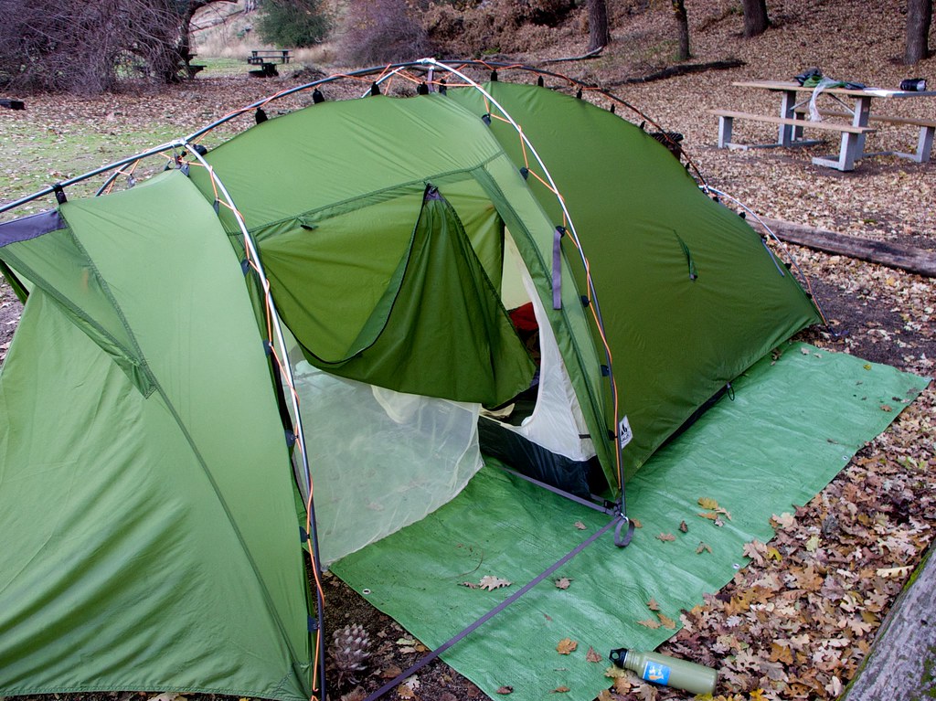
This tent was a combination Christmas/birthday present from a collection of friends and family members. (A “Vaude Hogan XT”) It kicks ass, and I extend my sincere thanks to all of you!
The whole thing, including poles, weighs less than 7 pounds. It’s roomy enough for two people and has this handy “vestibule” area where you can hide your bike from the weather (or thieves), and you can put it together in only a couple of minutes.
To put it together at night I propped the bicycle against a log a couple yards away and gave the front wheel a long spin, charging up the headlight, which illuminated the spot – but only weakly. I gotta get one of those head-mounted lights that I can plug into my battery pack.
This is another reason I decided to pack things up. Even at 10:30am, with the sun fully up, my campsite was wedged in the shade of a huge hill. The ground around here was going to get only a little direct sunlight, meaning it would be extra cold at night. Bah.
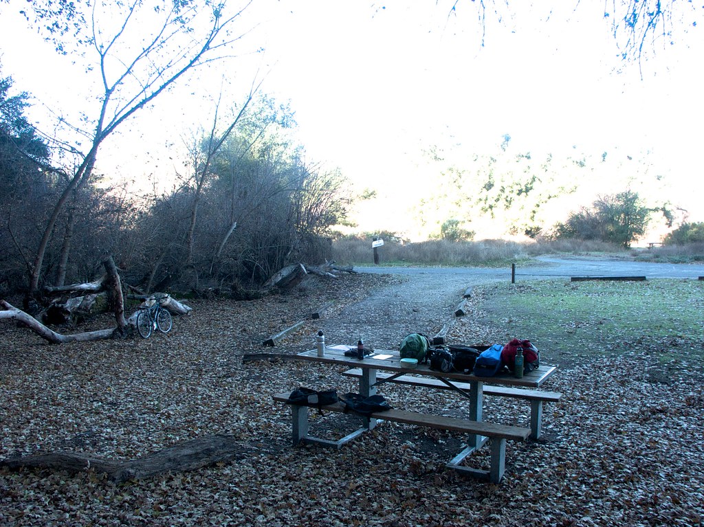
See all that crud on the picnic table? I brought that here on a bike! Heeheeeeeee!
After packing up I rode down into the preserve to eat lunch and relax. Here I’m eating one of the sandwiches La made for me before she left for Florida, drinking the bottled coke, and wearing my bike helmet to keep my head from frying.
The sun made me want to lay down and take a nap, but unfortunately, all the ground was either too hard, or too steep. Technically I’d spent ten hours in bed the previous night, but the sleep had not been comfortable. For some reason I’d dreamed about cooking a batch of chocolate covered almonds. I think that’s actually the first time in my life I’ve had a dream about cooking chocolate. Must be the calorie deficit talking.
Anyway, it was quite relaxing, and I wanted to call La and wish her a Happy New Year, but the whole National Monument area is devoid of cell towers.
On the way back out of Pinnacles, I stopped at the manager’s office and bought a huge bag of chips, since I felt hungry for salt. An old fellow saw me on the front steps began asking enthusiastic questions about my journey and my equipment, and I encouraged him to try something similar.
It was one of several conversations with total strangers about my trip. The first happened at the check-in desk of the Motel 6. The next one happened at the In’n’Out Burger where I stopped for french fries (a stocky latino looking dude), and the next was outside a 7-11 where I stopped for a banana (a tough looking black man).
The man looked at the banana, grinned, and opened the conversation with, “I should probably be eating that too, instead of these cinnamon rolls. Where are you biking from? Are you doing a tour?” What astonished me about that conversation was that he used the word “tour”, which is the proper technical term for the biking/camping journey I was on. Up until last summer, I hadn’t even known the term myself.
On the way back I was stopped in my tracks many a time by the sight of the winter sun illuminating the trees. The pictures don’t even begin to do it justice, but it’s fun to try.
There’s a lot of space here. Funny to imagine that the whole interior of California used to be this open; even San Jose. Well, San Jose was probably wetlands and forest, but, you know what I mean.
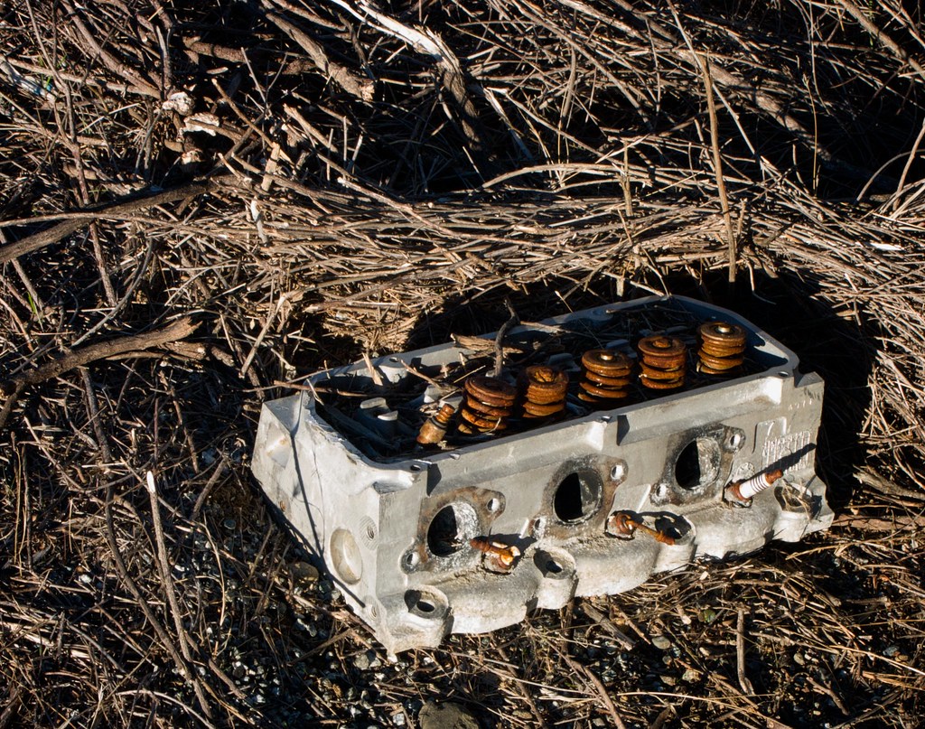
I’ve seen people throw away a lot of things by the side of the road. Earlier this day I passed three bleached skeletons – either dog or coyote – that had been hurled down the side of a ravine several seasons ago as bodies. Now here’s the remains of someone’s engine block. Eventually I’ll start seeing plundered treasure chests, tarnished oil lamps, and mysterious tomb carvings.
So there you have it. That ‘Lap 1’ marker is the place where I ate lunch on the last day. From there I rode 83 miles back to San Jose. I was going to stop in Gilroy, but when I got there, I washed my face at the In’n’Out Burger and sat down for a while, and decided that I felt good enough to ride the rest of the way home. Besides, my GPS read 48 miles for the day, and I wanted to finally break the 50 mile mark that had been eluding me all year.
As I pedaled for home I had to stop often just to give my wrists a break. They were hurting pretty badly from the weight of my leaning body, no matter what position I tried on the handlebars. Plus my sweater leaked through the teeth of the neck zipper, sending jets of cold air down my chest. La called me on the phone and she kept me company for almost an hour of my ride, which was very helpful, since it was quite dark beyond the range of my headlight and all I had to look at was an endless reel of curb and the cold pavement. She even told me a bedtime story, and stayed on the phone while she brushed her teeth. (The story was about a fish made of frosting, who lived on a cake, and took a journey to the sea and discovered he was actually a regular fish underneath!)
Every now and then I would concentrate on my legs and try to gauge how well they were doing. Would they wear out before San Jose? Were they getting cold? But they felt fine, and with the blood flowing a circuit between my exposed legs and my insulated torso, they were warm enough. They just kept on turning. I wasn’t even breathing hard. I know it sounds ridiculous, but I felt like I wasn’t breathing any more then I would just sitting in a chair, reading a book.
Just outside of the San Jose city limits I stopped and took one glove off to poke the iPhone, and wiped my chin with my hand. A mass of water spilled off my face. Apparently I’d been riding through the mist long enough for it to collect in my beard like a wet sponge, but it was the same temperature as the air so I never noticed.
Things Mr. Fins Learned On This Ride:
Motels are fricking EXPENSIVE.
This pastime is not as rare as I thought, which is a relief. I passed four or five very friendly bicyclists on my trip, including an old couple riding a geared-up tandem. Hooray for non-car journeys!
When the sun goes down on the road in winter, it gets cold FAST. And it takes time for the land to reheat when the sun comes up again. That leaves about 5 hours of riding time where you might be comfortable without nine jackets and twenty hiking socks on.
Salty snacks and sugar are easy to find on the road, but potassium is difficult. Pretty much your only choice is bananas at a fruit stand.
Going solo is relaxing and liberating, but without a riding partner, many things become difficult or even impossible. Shopping and using an urban public toilet are the worst. It’s ridiculous. This is not a problem for ANY other method of transportation, as far as I know. Except maybe camel.
A bike fully loaded with gear can get VERY heavy. Those little items add up fast. The good news is, with the increased weight, you can remain steady at lower speeds, so you can follow behind pedestrians on the sidewalk and make ’em all nervous.
And despite the extra weight, once you get a loaded bike rolling, it’s not hard to keep rolling. This was a pleasant surprise. I was expecting it to be like those exercise bikes in the gym whose idea of “hill” is a constant knee-aching resistance as if you were stuck eternally in the wrong gear. But the difference was one of inertia, not resistance.
For the last 8 miles or so I kept staring at the little blue dot on the iPhone map and yelling, “Move, damn you! MOVE!!” I was cold and tired and there was nothing to look at, and I just wanted to be off the bike. Two miles out, I began singing They Might Be Giants lyrics out loud, since the streets were deserted and I was getting a bit delirious.
But I made it. That was my first “official” touring adventure, and my first day over 50 miles. And my first day of 2009!