
Crater Lake Trip Itinerary draft 3
May 28, 2009 Filed under Advice
Overview:
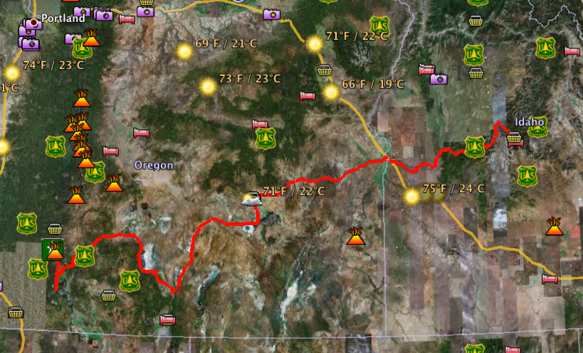
(Day 1)
Crater Lake Visitor’s Center
Dropped off here by pop. From here I’ll ride to a campsite within the park and stay overnight.
(Day 2)
Rocky Point Resort Rocky Point Resort http://www.rockypointoregon.com/maps.htm
40 miles south, almost entirely downhill. Will probably take less than 4 hours to get here.
$35 RV spots with electricity, $85 rooms.
(Day 3)
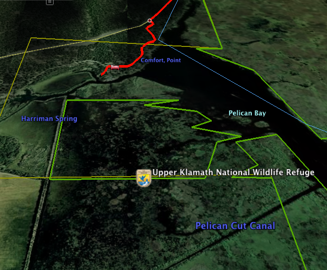
Upper Klamath National Wildlife Refuge
0.5 miles SW of the main compound are canoe rentals for viewing the wildlife preserve. Costly, but an excellent trip. Routes are clearly mapped within the preserve. Hundreds of bird species.
(Day 4)
24 miles N of Rocky Point. Dry unordered camping. Some kind of spring or lake on the upper edge?
(Day 5, a long day)
30 miles after Kimball, you enter a causeway over the Klamath Marsh National Wildlife Refuge. The water will be low here. There are rough campsites available here in the road complex to the right, including a canoe launch.
17 miles further, off the main road, is a large prairie that appears to be excellent camping.
(Day 6)
14 miles later you cross over some weird salt flats. To the north is a sinkhole/puddle. South is ostensibly a lake, but it’s likely dry.
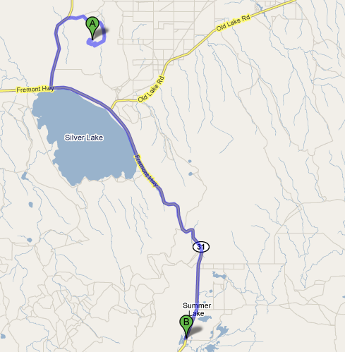
A few miles more will take you to the small town of Silver Lake. Be sure to replenish your water here.
Silver Lake Link
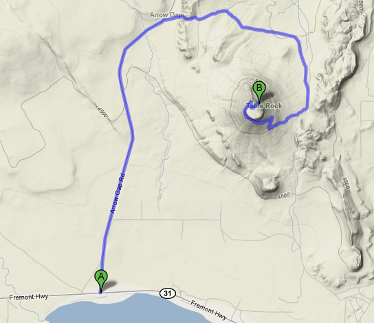
21 miles further, you’ll pass by Silver Lake. You may not realize this, as it will also likely be dry. To your north will be Table Rock.
Dirt road to ascend 1000 feet.
http://www.slopeflyer.com/artman/publish/table-rock-oregon.shtml
Campsites numerous and obvious at the base of the cone, none on the way up, the summit is entirely open. Sites are unimproved, “dispersed camping” conditions, pay attention to fire conditions as this area is extremely dry. Unless you see otherwise, if you are there in summer or fall, expect a fire ban is in place.
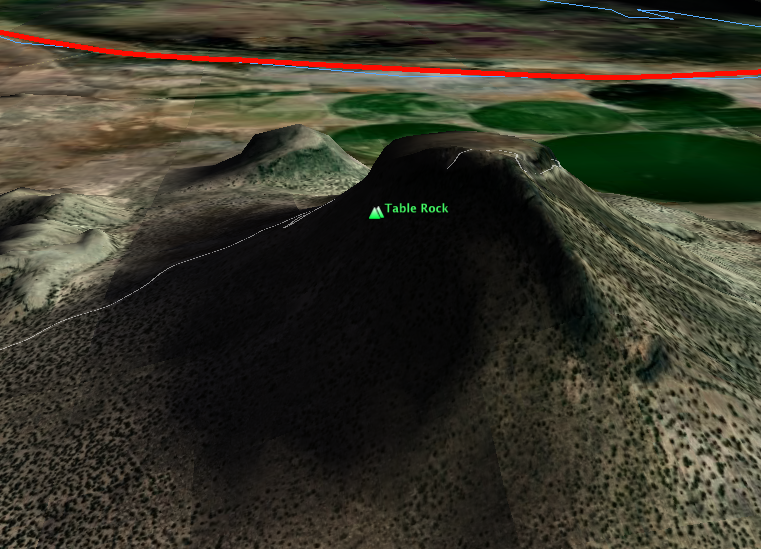
From the main road to the summit is about eight miles.
(Day 7)
Table Rock to Summer Lake Preserve
There is an RV park just before this area, but it may be on the upside of the hill.
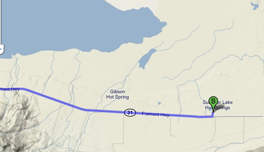
(Day 8)
Summer Lake Preserve to Summer Lake Hot Springs 41777 Highway 31, Paisley, OR 97636, phone: 541-943-3931, toll free: 877-492-8554
East side of Summer Lake, looking south:

South fringe of Summer Lake:
(Day 9)
Paisley Hot Springs to the Paisley Caves
The Paisley Caves to Paisley
Possible stay: The Chewaucan RV Park, 433 State Highway 31, Paisley, OR – (541) 943-3124
12.6 miles total.
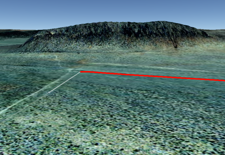
Paisley Caves hill:

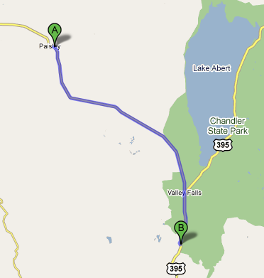
(Day 10)
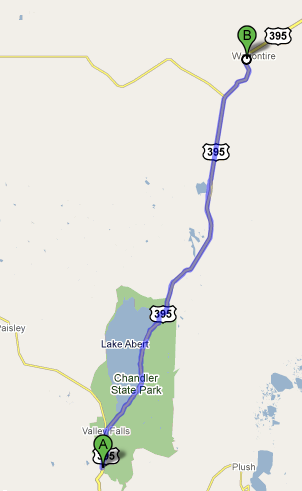
Paisley to the Chandler State Wayside Campground
In the lower quadrant of Chandler State Park. Free camping, limited spots, functional bathrooms.
You’ll pass through Valley Falls, which has a general store.
(Day 11)
Chandler Campground to Wagontire
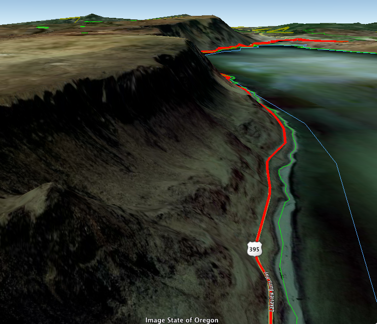
This is an extremely long ride, about 62 miles. You may want to stealth-camp out by the Alkali Lake that’s approximately 2/3 along this route.
Looking south, at the road along Lake Albert:
Wagontire Link
Wagontire is a busted up dirty wreck, but it has an RV park, a cafe, and a cheap motel. You better get some water here because Riley is 30 more miles out.
(Day 12)
Weird dry lake Link
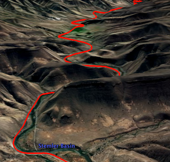
27 miles and approach the town of Riley. If you’re looking for a neat sight there’s some kind of bloody red quarry/riverbed off the road leading down into town, to the east. More free dry camping if you’re tough enough for it.
Riley
2 miles further down the main road, you merge with Highway 20 at the town of Riley. There’s a truck stop here … take advantage of it. From this point you have a bunch of options. The smartest one is to head due east on the highway until you get to Hines. You could also turn SE and angle towards Harney Lake, a hugeass flat white salty expanse of nothing. To get to the middle of it you’d have to go almost 40 miles. The good news is you’ll pass by a reservoir. Still, it’s probably not worth it.
Hines Link
26 more miles east you’ll eventually turn north and pass by Hines, which appears to have an RV park. Probably a good place to find a shower and snacks.
(Day 13)
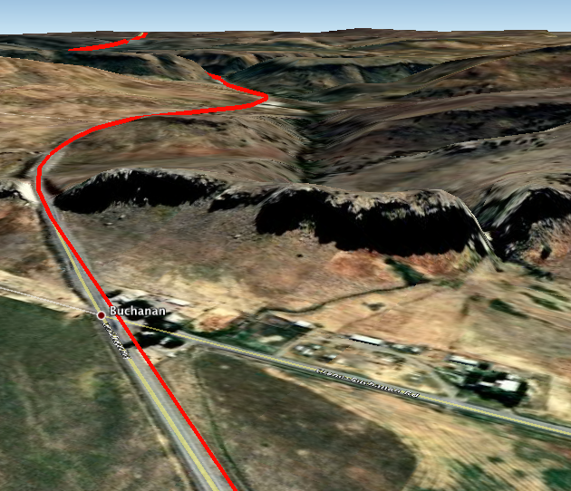
Buchanan Link
26 miles straight east on the Central Oregon Highway and the road will curve NE. Then you’ll see a funkyass hill with Buchanan as the foot. Another snack stop.
Buchanan Springs Link
1 mile up the hill you’ll see a turnout for the Buchanan Springs. Probably dried up and gone now, but the buildings are still around.
Indian Grade Springs Link
2 miles further up are the Indian Grade Springs. I don’t know what the heck is up with this. Just a hole in a barren hill with water in it.
Drewsey Link
17 miles, including a 2 mile left turn on the only paved road. There’s a lot of hill climbing here – you may not make it all the way in good time. But Drewsey has steady water supply and appears to be a good place for snacks.
(Day 14)
Juntura Link
18 miles on good highway. Just outside of Drewsey, back on the main road, you can expect a 1000 foot climb to the top of a hill, followed by a lot of coasting.
Harper Link
34 miles east you’ll eventually roll into Harper. The road is very curvy here, but flat, and the mountains are gorgeous. You’ll probably want to stop somewhere and stealth-camp before Harper. The city is to the NE down a road called Harper Junction and is large enough to sport a stadium.
(Day 15)
Vale Link
21 miles more, to the city of Vale. A sizable city with a motel called the Bates Motel. Gotta love that.
Fruitland Link
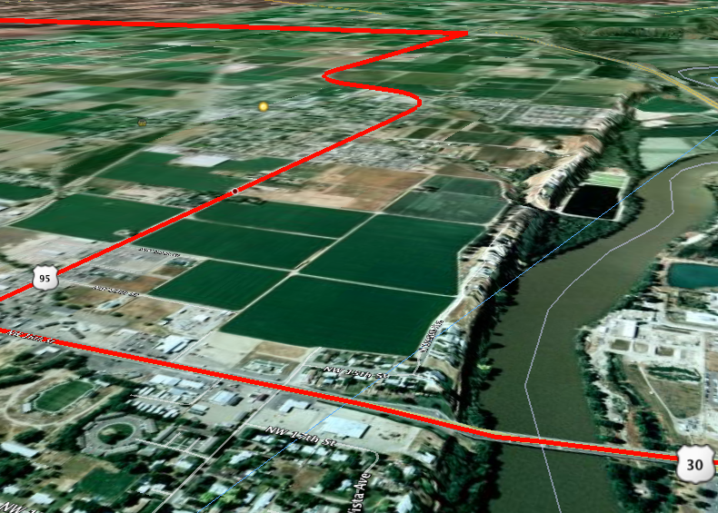
18 miles more and you’ll arrive in Fruitland, across the border in Idaho. This city is merged with Ontario, which you will have already passed. Plenty of places to stay a night in relative comfort here.
(Day 16)
Horseshoe Bend Link
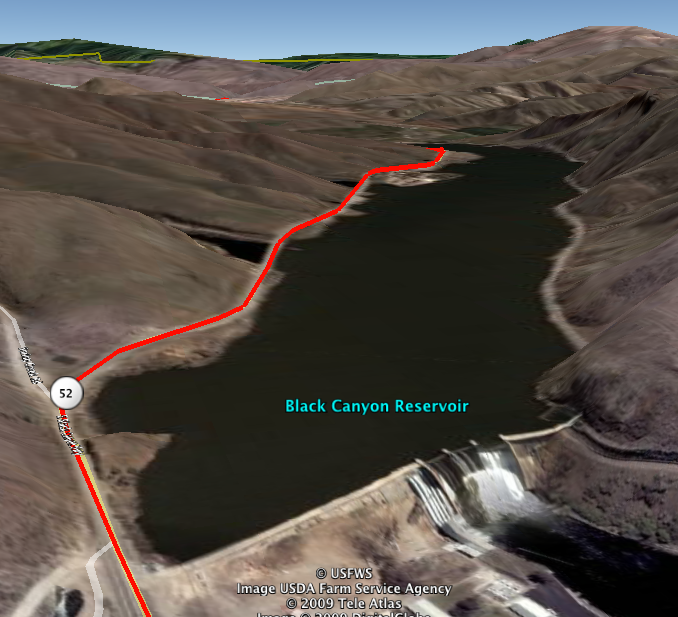
47 miles to this city, SE and then E. There are many other places to choose from, but this is probably the smartest. You’ll pass the Black Canyon Reservoir on your right when the road gets curvy,
(Day 17)
Grimes Pass Link
32 miles and about 1000 feet of climbing will take you to Grimes Pass, past many designated campgrounds. The campgrounds thin out beyond Grimes Pass for a while until you get most of the way to Lowman, so depending on how lazy you feel, you could stop anywhere around here.
(Day 18)
Lowman Link
17 miles from Grimes Pass to Lowman, and 500 more feet up.
Bonneville Hot Springs Link
19 more miles and 1000 feet up, past an airport strip and along a crappy road, you’ll find a campground near the alleged Hot Springs of Bonneville. We Shall See. There is also a Forest Service Facility in this area, though I don’t know what the hell those are for.
(Day 19)
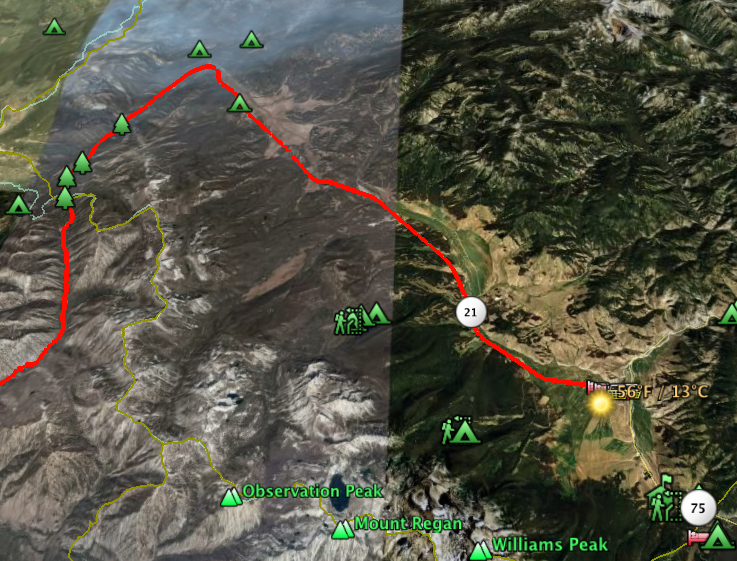
Stanley Link
39 miles and 2000 feet more and you get to Stanley. The last third of the route is a long downhill coast into the valley where Stanley is. Many places to camp along the way – take your pick.
(Day 20, Day 21)
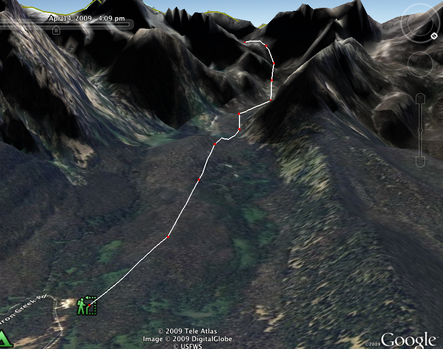
If you’re feeling ambitious and tough, the best thing you can do in Stanley is hike up to Sawtooth Lake, starting from the Iron Creek Trailhead and the campsite nearby (see the last link, above). It’s a three mile hike that goes about 1500 feet up.
For comparison’s sake, a hike from Sand Pond to Upper Sardine, all the way around the lake, and back down to Sand Pond is 2.75 miles and involves a climb of about 700 feet. So this is basically twice as hard of a hike, multiplied by two. You will need to provide for carrying a full load of camping gear. The only way to make this practical is to wait for backup from the La.
Hike overview:
http://www.bikeroutetoaster.com/Course.aspx?course=51360
Google Earth KML file: Crater Lake To Stanley 2.kml