This is about as dark as it ever gets at night here.
It was time to wash the sleeping bags. Partly because it had been years, and partly because I knew Rachel would soon be arriving and I didn’t want her to be stuck with a grody sleeping bag. My sense of smell is annoyingly selective, and while microscopic amounts of air freshener or perfume drive me insane, the funk of a sleeping bag that a college kid has been rolling around in could be totally imperceptible to me. The bags smelled okay but I didn’t want to take the risk.
I left them for a while to grab a snack, which was against the rules, and when I came back I heaped them onto the bike and coasted downhill to the park in front of the hotel. Plenty of sun here for drying. I just needed to make sure the wind got both sides.
It takes a very, very long time to dry a sleeping bag.
I sat next to the sleeping bags and poked my laptop for hours, and the day moved on. Clouds gathered across the sun and the temperature dropped, so I took the bags inside and draped them on whatever was handy.
Even with the hours in the park, I still had the urge to sit quietly. Andrew and Nick were still exploring and I didn’t want to just hang around in the hotel alone, so I decided to bike to a nearby cinema and see the new Indiana Jones movie. Not bad! It was late on a Sunday and the movie had been out for a while, so I had the auditorium almost entirely to myself.
When I got out of the theater I noticed a missed call from my nephew James, so I called him back and we chatted for about an hour. As we talked I rode the bike, turning randomly at intersections towards whatever seemed like the quieter part of town. Eventually I rolled to a stop outside a late-night bakery on Leith Walk.
The place had donuts filled with custard, as well as cheese and onion pasties, which I mispronounced as “pastries”. I bought one of each, then stood around on the sidewalk nibbling the chocolate off the top of the donut because I’m a “dessert forward” sort of eater. In the meantime two people came up the sidewalk trailing an enormous shaggy dog on a long leash. One of them went to in to buy snacks, and only a few moments later the proprietor came out with a small steak pie and sat it on the ground in front of the dog, who leaned down and ate it in one bite, then licked the sidewalk for a while as the humans chatted.
As I stowed my remaining snack and got on the bike, I heard one of the dog owners explain to the proprietor that she was worried for her housemate, because he had smoked way too much pot, and then started rolling back and forth on the floor repeatedly insisting that he was “an egg.” Her tone implied true concern, and I couldn’t decide if that was actually more hilarious than the antics of the pot smoker.
It only took five minutes to zig-zag my way back to the rental, and I spent the time chatting again with James while chewing on a warm onion and cheese pasty. When I stood up from the bike a small pile of crumbs tumbled off the front of my jacket.
The rest of the crew was already inside and settling down for the night. The weather was warm enough for us to leave the window open, and for a while I watched the birds churn around in the sky. We were technically as far north here as the southern tip of Alaska, so it never got truly dark.
I packed up my campsite, then rolled through town to the fancy hotel room. I needed to spend one more day here to line up my schedule with the room I’d booked on the 13th, 52 miles to the east.
After my conversation with Paul I realized that I was probably doing things too formally, and I could just ride out to the hotel even though they were fully booked, and ask to pitch my tent on the lawn behind their building while waving 40 bucks at them. These hotels are generally not big regulated chains, but privately owned establishments run by locals who can bend their own rules when they feel like it. And 40 bucks is 40 bucks, right? Not a bad profit for letting a guy sleep on a patch of lawn for 10 hours and maybe use your toilet. I mean, I’d take that deal, if the guy didn’t seem too sketchy.
But that wasn’t the groove I was in just now. In fact, today I wanted to just enjoy my fancy discounted room and luxuriate in a bed that didn’t need inflating, and use a private shower without a timer.
The fanciest hotel room of the whole trip, I suspect. Got it on a deep discount.
With the bike indoors, I decided to clean and tune it, since it was way more comfortable lying on a clean floor than wet grass. As I wiggled around tightening bolts, I could feel my body flexing in ways that I was unable to make it do just a month or so earlier. Burning well over 5000 calories a day has benefits.
It wasn’t until dinnertime that I realized I’d washed all my socks at once. I reluctantly squished my feet into a pair and headed for the fancy hotel dining room. Everyone there was well-dressed, and my sweater and pants were classy enough but my gross socks were something a teenage boy would wear. I was probably the only person to notice. I ordered the soup of the day, plus a piece of Arctic char, a hamburger, and a mug of hot chocolate. The fries were extra crispy and combined amazingly with the fish. I only managed to eat half the food, so the rest came with me to the room in a cardboard box.
I wondered how much of the meal had been brought to Iceland on a container ship. Certainly the potatoes, the beef, and the chocolate. Also the cardboard box, napkins, table, and chair were imports, since those were wood. Oh, and the cotton tablecloth. And the silverware. And… I realized the list could go on and cover almost everything around me. Including me.
Global commerce is weird. When I’m in this hotel, am I even technically in Iceland at all?
Going a long distance on two wheels is a relatively recent human pursuit. Especially doing it for fun. Aside from the two most important modern creations that make this possible – the bicycle, and the road itself – there is another thing we have come to depend on, to make the adventuring safe and successful: An accurate, portable map.
We rely on the map to get from one meal and bed to another, with a minimum of backtracking and unpleasant surprises, in environments where those things are rare, or where the signs for them are obscure. It becomes more important the farther we wander from home. We have developed a certain level of trust in the map, and therefore in the people who constructed it: We expect them to tell the ground truth, with no artistic embellishment.
In the middle of long, winding roads through mountain passes, with many forks branching ahead of us, and daylight waning, and just a few hospitable dwellings marked out, our very lives can depend on the accuracy of a map. Guiding us safely and accurately in those situations – and all others – is what the modern map is for.
This was not always the case!
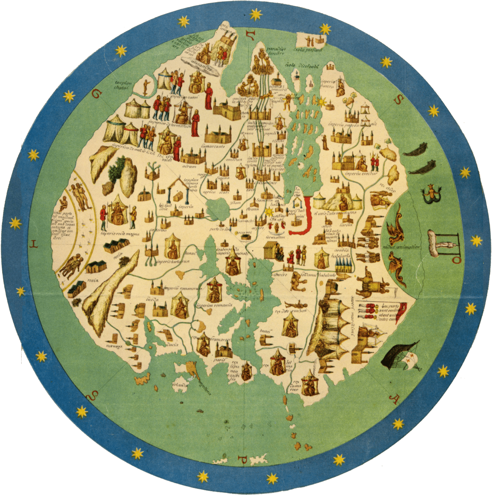
World map assembled by Andrea Bianco in 1436
Here There Be
In Europe back in the 15th century, maps of the world were not used for navigation, but as propaganda and entertainment. Large-scale maps were weirdly inaccurate and chock full of exotic labels and figures to stir the imagination — and sell more copies to the curious middle class.
A dabbling dilettante might purchase a map just to pass it around at a social gathering, and inspire their friends to trade rumors and tell outrageous stories:
“Hey, look at this island here – Ewaipanoma. There are weird headless people on it. Instead of a head they have eyes bulging directly out of their chest, and a giant mouth in their stomach. Here’s a drawing; it must be real!”
“And look at this chunk of ocean. It’s labeled The Red Sea, and wow, it’s blood red! I wonder what it’s like to sail across that. Does it stink? Are there Mer-men in it? (Excuse me; could you pass the snuff?)”
Detail of Martin Behaim’s Globe from 1492, in a facsimile produced in 1908 by the geographer Ernst Georg Ravenstein
Map makers of the 15th century were taking liberties with the irregular facts at hand to tell a good story, and sell a few more maps. These creations were works of art as well as reference, and so they embodied both knowledge and attitude, and to our modern eyes it’s also clear that by exaggerating the freakiness of the non-European world they stoked the common racism and religious bigotry of the time. Given that the average person was never going to travel outside their home country, how would they know any better?
If the map maker Andrea Bianco mislabeled an entire continent and made the inhabitants out as monsters, no one could call him on it. Maybe they were all just godless aliens out there, and we should put a pre-emptive boot on them, for our own peace of mind… (And so, 400+ years of colonialism.)
Iceland, depicted in the Carta Marina from 1539, enhanced with color. The ice floe has long since melted.
This kind of distortion is not just in relics from the past. It can appear in any art that depicts a far-away place, including very modern media. The line between entertainingly fanciful, and offensively alien, tends to drift as well.
Europe as represented on a Japanese map from 1932. That’s Hitler tussling with then-president of the Weimar Republic Hindenburg in Germany.
Consider our modern obsession with space travel: We have made a few tentative steps into the solar system, but the facts have been eclipsed in popular culture by Star Wars, Avatar, Star Trek, et cetera. 15th century maps had their “headless men”, and we have our “alien xenomorph.” If we landed a spaceship on some cold moon of Jupiter and found it was teeming with creatures that looked and sounded just like the “xenomorph”, how many of us would freak out and want to kill them all immediately, despite their scientific importance? Despite the fact that for all of human history up to that point they’d left us alone?
Believing in a universe full of hostile aliens can sound like common sense in any era: You’ll never be caught with your guard down. But like most common sense, there’s a blind spot, in this case big enough to fit the whole of the colonial era inside: Keep your xenophobic guard up and you might be an unwitting sponsor of atrocities against perfectly ordinary people. The more truth – or perhaps just dignity – we gather into our representations of the world beyond, the less likely we are to start a war.
If only you understood them, you could avoid disaster… (Alien Legacy, 1994)
And so, better maps make better neighbors. Instead of believing the world is full of savages that need colonizing, we learn that the world is full of people, and the colonialism is the savagery. Xenophobia inspired by artistic license slowly loses ground to the need for navigational accuracy.
The Shrinking Stage
In 1570, when William Shakespeare was 6 years old, the first book of maps was published. Reflecting the culture of the time, this book – effectively the first ever world atlas – was titled “The Theater Of The Lands Of The World.” It aimed for something more serious than middle-class entertainment: A truly accurate geographical representation, suitable for outlining an actual ocean voyage. The world remained a theater but now it was one that real people might act upon.
The Greek peninsula, according to the Orbus Terrarum
Ten years after that first edition (the first of many) was published, Sir Francis Drake returned from sailing around the globe – the first Englishman to do so – with a hoard of gold, silver, and spices he’d plundered along the way. The treasure was so great (and he’d been gone for so long) that after he dropped anchor in Plymouth Harbor, he had to wait quietly on his ship until midnight, and then send a small anonymous party ashore to find out if Queen Elizabeth was still in power and could still provide protection while he unloaded his riches. The success of the journey was a huge surprise, and fanned the flames of the public obsession with the uncharted world past the horizon. The world was full of mystery and monsters, and it was also full of treasure, and real men had sailed out upon it and brought some back. Perhaps anyone could.
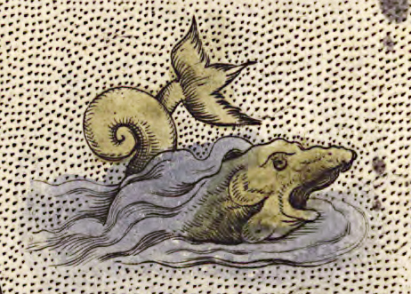
An Orbus Terrarum sea monster
Twenty years after that, when Shakespeare’s company was popular enough to commission its own theatre space, what better name to seize the imagination than “The Globe”?
The globe theatre, as depicted in an engraving by I. Hondius in 1610
As maps became more accurate, the globe became more accessible, and less terrifying. In our modern age we’ve taken this about as far as it can go: The entire Earth is a pale blue dot on the screen of a smartphone, easily covered with the palm of one hand — yet anyone can use their fingers to zoom the image continuously down to the individual trees on the street outside their house. If we can see the people on the opposite side of the planet just like the people living on our own street, we are less inclined to demonize them and more inclined to collaborate, and a vision of the human race as a single tribe spanning the globe is within reach. That is a fantastic development.
At the same time, this increase in accuracy has increased our tendency to substitute one scale for another. It becomes very easy to believe that all movement is the same regardless of scale, and that all places in the world are equally well known — because they’re all on one map, and everyone uses the same map, aside from some tiresome arguments over border lines and labeling. Through that we developed an unwarranted sense of familiarity.
Human brains evolved to keep track of about 100 personal relationships and a few square miles of land in detail at most, and brains haven’t changed in the face of this new technology. To conceive of the entire planet as one place, we have to skip over a literally inconceivable amount of detail. We reduce huge chunks of territory and uncountable numbers of people down to a photo, a paragraph, or an icon beneath a finger, and let the rest blur into mush.
Affordable, decentralized communication has made the whole world more familiar, but it has also made the world seem smaller and much more consistent than it really is.
How Americans view Europe (courtesy of Ducktales)
Play’s The Thing
I can flick the screen of my smartphone, scrolling from my home town over to the Great Pyramid of Giza and “see” all the terrain between, thanks to satellite mapping. I can board a plane, spend 17 hours napping uncomfortably, pop out next to the pyramids, walk all around them, and then fly back home, all in a few days. I was here; then I was there; then I was here again. The dot on the map tells me so.
Everything I skipped over is just a gradient between the familiar experience of home, and the foreign experience of the pyramids, and since there are no big fancy icons on the map in between, I haven’t missed anything important, right? I can look out the window of the plane and see the terrain scroll by just like on my smartphone. Looks about the same.
This is what travel is for us now. Even when we would rather move slowly and see the land between, we are thwarted by the need to get back to our job and other obligations — and so we rely on the dot and the map to tell us that yes, we have really gone somewhere.
Everything looks so flat from up here...
We instinctively know that we’re missing something. We instinctively know that when Shakespeare wrote “the world is a stage,” he was getting to something important. In airplanes and trains and cars, we can skip around the globe like stones across a pond, but traveling that way is the equivalent of sitting down for Act 1 of Hamlet, hearing a few of the opening lines, and then suddenly it’s Act 5 scene 2 and everyone is scattered around dead, and Horatio is all, “What is it ye would see? If aught of woe or wonder, cease your search.”
We know some important changes have happened. We can see the evidence all around. Based on what we see, we can assemble the story of Hamlet like so: A bunch of people were alive, then they fought and almost all of them died. That summary would not be wrong. But of course, there is so much more. It’s all there, in the terrain we skipped; the scenes we didn’t watch…
The Unbroken Line
What if you could leverage the modern map to travel safely and accurately, but also experience a story that plays out across this world stage, with no interruptions? What if you could move through the scenes and have the time to notice all the details that haven’t been granted a symbol on the global map?
What if you could establish a truth inside you as a counterpoint to the gridwork of flight-lines that link monuments and urban centers: The entire world as a continuous place, every corner of it real, every person on it part of the play? What is it like, to be in those in-between places long enough to know them as their own? To breathe that unbroken channel of air that is split aside by the plane, or the train, or the windshield of the car?
With a bicycle, you can find out.
It's not very direct, but it sure is pretty
The maps available in this modern age are exquisitely, astonishingly accurate, and are no longer full of headless men and blood-red oceans, and can be mined for information in ways that were unknown just half a generation ago — or even just a few years ago. With a smartphone in your hand, you can see your exact spot on the globe, inspect the terrain ahead, find a place to stay, find food and water, book transportation, locate supplies… And beyond the map, you can see weather predictions, manage your finances, contact emergency services, practice speaking and reading a language, and call up someone you know to ask for guidance. And the device you do this with fits perfectly on the handlebars of a bike, and the battery lasts all day!
Our modern maps can guide you safely, because they are no longer infested with artistic embellishments like “here there be dragons”. But nevertheless, the regions they cover are full of adventure and surprise, as they always have been. From the seat of a bicycle, you can discover it. The possibilities for lightweight, independent, flexible travel are far, far greater than they’ve ever been in history.
All you need is the inspiration to think outside of the literal box: Why buy a tour package to some big-name destination, and sit on your ass in a series of metal boxes that haul your body across the space between, rendering it intangible and irrelevant, when you could have a continuous sensory experience, breathing the air, hearing the wildlife, seeing the terrain unmediated, feeling the rain and wind and sunlight, knowing the change of the land with your own muscles?
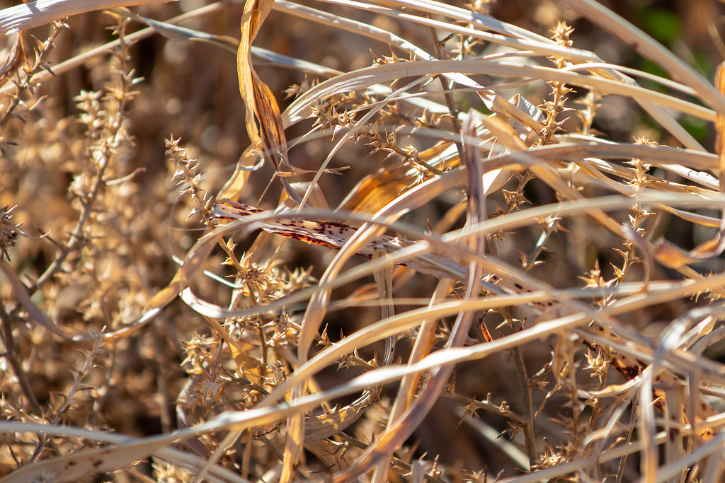
The shapes and colors and textures of the grassland are enthralling.
Joyous late fall colors.
Growing quite a beard...
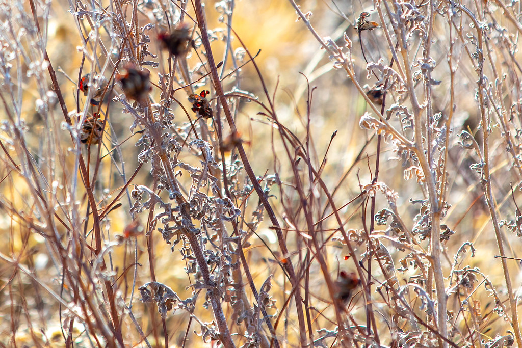
The closer you look, the more diversity you find, in plant and insect life.
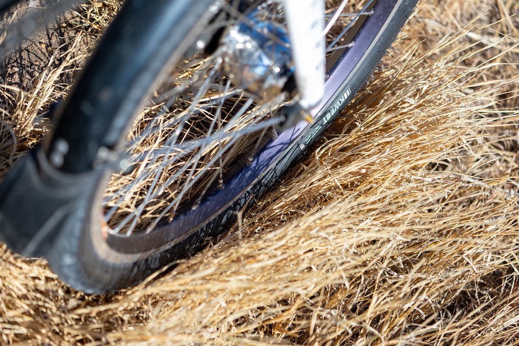
Every time you roll onto the grass, you take a risk. There are incredibly sharp burrs scattered within, and a heavy bike will punch them right through regular tires.
Plenty of hay for the snacking.
Margaret calls this animal a "Tire-rim-asaurus Wrecks!"
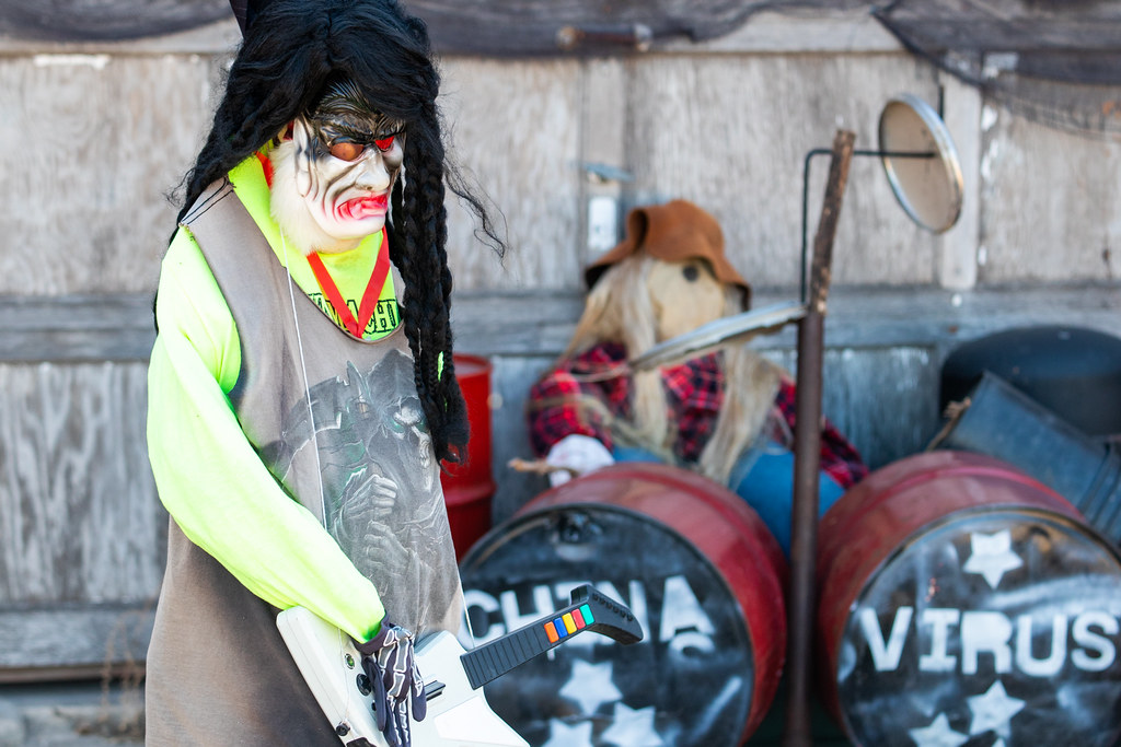
Hisssssss!
Assembled 27 years ago and holding up well, apparently.
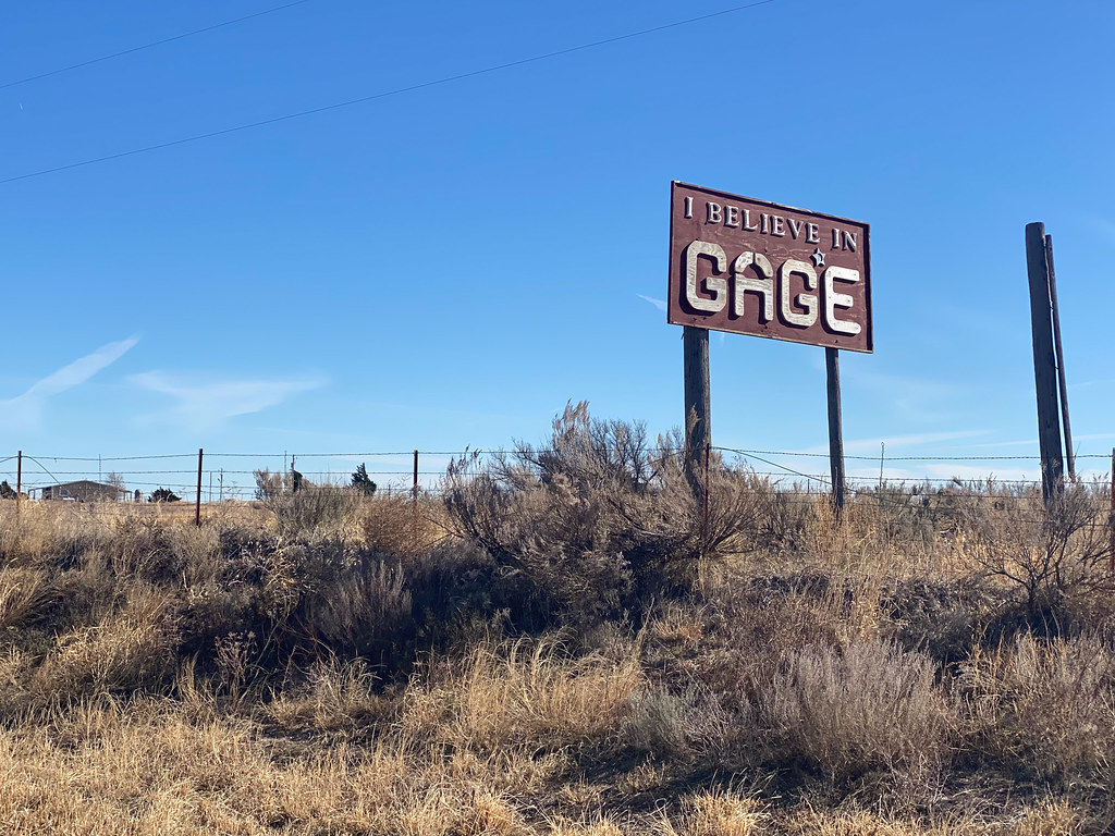
Thanks, Jim, for the roadside amusement.
I'm glad someone does. The town could use some help.
I wish I had time to visit every one of these cemeteries and lounge in the sunlight.
Curious critters.
Tagged for reference!
Cows in the sun.
Chomp chomp chomp chomp
A fox darting across the road. A truck slowed down for it.
If you try to attach a plow to me, I'll kick your face in!
They're coming up to greet me, in quite a hurry. They'll be disappointed: I have no snacks!
Critters outstanding in their field.
Just in case you're not already aware of the critters here.
I have never encountered a sign quite like this, anywhere else in the world.
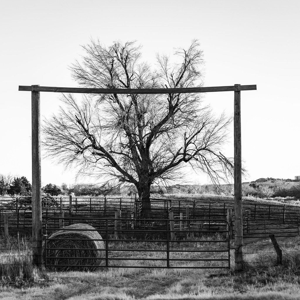
Welcome to the tree ranch!
A gas refinery, I believe.
Only a few more miles to go today!
Five miles of no shoulder. Thanks, Oklahoma.
Pick a direction: More flat!
I don't know who set this up, but... Well played, my country friend.
So that's where all the boomers are!
You knows it!
Parked after a long but interesting day of riding.
I would have really liked to find the old family farmland and walk around on it — or at least known which parcel of land the farm used to be on, even if there was a warehouse or an industrial crop circle built over it now. But with only a few photos from 1981, the name “Pony Creek”, and an old topographical map, I couldn’t solve the mystery.
An old topographical map showing Pony Creek near Shattuck
An old topographical map showing Pony Creek near Shattuck
My conversations with locals didn’t scare up any new information. My father and I poked gamely around in satellite view, trying to reconstruct the route he remembered driving out of Shattuck to get there, but he’d made the journey only once, 40 years ago. Nick and I would have to be satisfied with a general impression of the area.
And an amazing impression it was. The late autumn colors and the layered flatness of the terrain were very unlike our California home, and the wide open sky above that terrain seemed to command our attention in a way that the skies back home rarely did. Everything up there was bigger: Massive clouds, sprawling sunsets, driving winds, fat raindrops. And we were at the mercy of that sky. Whatever it brought, fair or foul – or maybe even apocalyptic – there was no place to hide from it.
In fact, even with headwinds punishing us for several days of the trip, we’d been pretty fortunate. We could have had to pedal through lashing rain, or hide indoors while lightning blasted around us and the highways flooded. The one time the wind really picked up to something nasty and was hurling debris, we happened to be riding in exactly the same direction and were swept along, more than doubling our speed for the entire day.
All we had in Shattuck was a little wind and a sprinkle of rain, and otherwise the days were clear and crisp. I even got to work outdoors!
Usually I wear a much bigger hat for working outdoors!
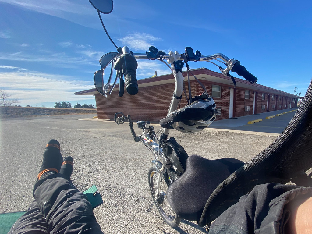
Lounging in the sun, in the otherwise empty motel parking lot, getting some work done.
Our plan was to spend a final day here, then cycle east to Woodward and hunker down for a few days until a U-Haul truck became available. Then we would throw in the bikes and zip down to Fort Worth, poke around there for a day, and then the trip would be officially over with the loading of Nick on the train back to Los Angeles. Originally I thought we would be able to get to Fort Worth entirely by pedaling, but work hours and extra rest days compelled a change. We got to Shattuck; that was the main thing!
One more day of crossing this amazing terrain by bike. Time to make the most of it.